| Rating | ★★★★☆(4/5) |
| Overall Difficulty | Moderate |
| Navigation Difficulty | Medium |
| Distance | 2.2 miles roundtrip |
| Time | 1.5 hours |
| Terrain | Hilly |
| Best Seasons | Spring, Fall, Winter |
| Family Friendly | Yes |
| Dog Friendly | Yes |
| Accessible | No |
Highlights
- Amazing views of Las Vegas
- Interesting geology and vibrant colors
- Opportunities for scrambling and exploring at the top
Hike Summary
While most people associate Las Vegas with gambling and partying, not far from that epicenter of indulgence you'll find amazing hiking at Red Rock Canyon National Conservation Area. One of the most popular trails is this scenic route in the Calico Tanks, named for the rock formation with alternating patches of red and white color. At the end of the trail, you'll enjoy views of the Strip's towering hotels. In addition to incredible scenery, the Calico Tanks Trail is adventurously fun as you follow stone cairns across giant slabs and climb rocky steps to the final viewpoint where you can choose to scramble even higher up the massive rock formation. Whether you're trying to sweat out the previous night's mistakes or looking for a healthy alternative to buffets, this hike will leave you satisfied.
From the parking lot, follow the trail into the desert. On the right you'll see blobby beige and rusty brown rock formations -- the Calico Tanks. Behind you, you'll see the tall cliffs with the colorful bands of alternating rock layers Red Rock Canyon is known for, as pictured below. Pay attention to the trail as it trail crosses the gravelly wash or you may lose your way. Worst case scenario, you can follow the wash north and you'll eventually find the trail again. Shortly after crossing the wash, continue going straight at the intersection with the Turtlehead Peak Trail.

The sun setting with the walls of Red Rock Canyon in the distance

The trail travels on top of these red and white rocks

The skyline of the Vegas Strip and downtown beyond the calico colored rocks

Red rocks and mountains in the distance
The Calico Tanks Trail is just one example of the spectacular hiking near Las Vegas, so on your next trip step away from the Strip to somewhere natural and beautiful! You'll love the colorful rocks and the fun but challenging trail to a great city view. Connect with me using the social media links below and share your adventures!
Important Information
Dogs are allowed on leash. This trail is short enough that it should be doable for kids, and the opportunity for adventuring on rocks at the end will be especially fun. Summer temperatures are brutally hot, so hike this trail in the fall, winter, and spring when the weather is nice. In any season, bring plenty of water and wear sun protection. This is one of the most popular trails in the park, so expect a crowd.
Directions
From Las Vegas, take Clark County Highway 215 west and take the exit for Charleston Boulevard in Summerlin. Turn left and continue straight. Turn right on Red Rock Canyon Drive, signed for the park and visitor center. Pay your fee at the drive-up station ahead, then continue onto Scenic Loop Drive. Turn right to park in the Sandstone Quarry parking area.
Google Maps Directions
Parking, Fees, and Facilities
Vehicle entry fees are $15 per day or $30 for an annual pass (a serious bargain if you think you'll come here at least one more time this year). Federal Interagency Passes (i.e. America the Beautiful Pass) are also accepted here. More information is available at the park's "Planning Your Visit" page under "Fees and Passes". This trailhead is extremely popular, so finding a spot may be difficult -- come early! There are pit toilets and a map kiosk here.
Nearby Hikes
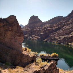
Lake Mead National Recreation Area, Arizona
★★★★★(5/5)
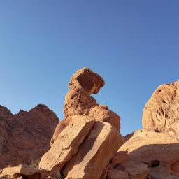
Valley of Fire State Park, Nevada
★★★☆☆(3/5)