| Rating | ★★★★☆(4/5) |
| Overall Difficulty | Easy |
| Navigation Difficulty | Easy |
| Distance | 2.2 miles roundtrip |
| Time | 1 hour |
| Terrain | A few hills |
| Best Seasons | All |
| Family Friendly | Yes |
| Dog Friendly | Yes |
| Accessible | No |
Highlights
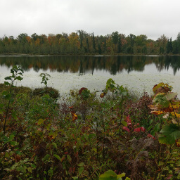
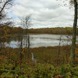
- Mississippi River views from the top of Chippewa Lookout
- Historic town of Crow Wing
Hike Summary
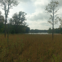
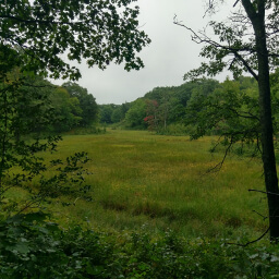
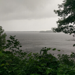
Just outside of Brainerd and right off of Minnesota Highway 371, Crow Wing State Park is an ideal stop on a journey up north. This hike will only take you about an hour and features a beautiful view of the Mississippi River and a historic town site all connected by a trail along the river. Both the townsite and the Red River Oxcart Trail that you will travel are on the National Register of Historic Places. In addition to being a place of convergence for two rivers, the three main landscapes in Minnesota also meet here: prairie, pine, and hardwood.
Dogs are allowed on leash. Like most Hiking Club trails, this is an excellent family friendly hike great for introducing kids to hiking thanks to the variety of things to see and the short distance. The trail is available for hiking in all four seasons, but it is ungroomed in winter. There was only one other car parked in this lot when I visited on a Friday afternoon, but expect to see many more people on weekend in the summer.
From the parking lot, follow the paved trail past the shelter. Continue on the path along the river as it turns to dirt. In about a quarter mile, you will arrive at the historic townsite, a grassy meadow nestled between pine forest and the river featuring the one building pictured below, several educational signs, and a boardwalk along the river designed to look and feel like the original. Feel free to wander around on the many short trails to envision how the town originally looked.

Continue on the trail back to the parking lot, staying straight at the intersection ahead. Eventually this trail converges with the trail you originally took by the river and you may retrace your steps back to your car. This is a perfect stop to break up a long drive up north and the scenery will keep you entertained throughout. Let me know what you think in the comments section below, and be sure to use #nocoastbestcoast on Twitter and Instagram!
Directions
From the Twin Cities, take Interstate 94 west toward St. Cloud. In Monticello, take the exit for Minnesota Highway 25, then turn right. After crossing the river, turn left onto Park Boulevard. Turn left onto U.S. Highway 10. In Little Falls, stay right to continue on Minnesota Highway 371. Look for signs for the park in about 20 miles and turn left. Pay the fee at the park office on the right, then continue straight until the road ends at the parking lot.
Google Maps Directions
Parking, Fees, and Facilities
Like all Minnesota State Parks and Recreation Areas, you must pay a vehicle entry fee of $7 per day or $35 for an annual pass (highly recommended if you frequently go to Minnesota State Parks). There are flush toilets and a shelter near the lot.
Nearby Hikes
Mille Lacs Kathio State Park, Minnesota
★★★★☆(4/5)
Father Hennepin State Park, Minnesota
★★★☆☆(3/5)
Rice Lake National Wildlife Refuge, Minnesota
★★★★☆(4/5)
Chippewa National Forest, Minnesota
★★★☆☆(3/5)