| Rating | ★★★★★(5/5) |
| Overall Difficulty | Easy |
| Navigation Difficulty | Easy |
| Distance | 2.2 miles roundtrip |
| Time | 1.5 hours |
| Terrain | A few hills |
| Best Seasons | All |
| Family Friendly | Yes |
| Dog Friendly | No |
| Accessible | No |
Highlights
- Fantastic tilted sandstone formations
- Scenic overlooks
- Variety of landscapes and wildlife
Hike Summary
Out of all the hikes I've done on my trips to Denver, the Fountain Valley Loop in Roxborough State Park is my favorite so far. This short loop has it all: scenic overlooks, cool rock formations, and a historic homestead. Though you may struggle to wake up early enough on a weekend to snag a parking space, the effort is certainly worth the reward.
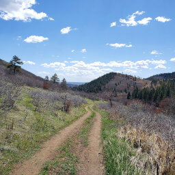
Save for the short uphill segments to the overlooks, the hardest part of the hike is the ascent from the parking lot to the start of the trail at the visitor center. Before starting your hike, you can go inside the visitor center and learn a little about the geology and wildlife present in the park as well as pick up a self-guided trail brochure for the hike. Once you're ready to go, follow the signs for the Fountain Valley Trail. The trail is immediately scenic, with sandstone formations to the south.
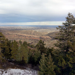
About a tenth of a mile from the visitor center, you'll reach a short spur trail to the Fountain Valley Overlook. A few steps up, and the trail ends at the nice view looking to the south pictured below.

One view at the Fountain Valley Overlook

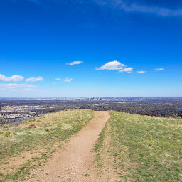
Looking north towards the hills and rock formations

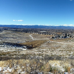
The view from Lyons Overlook

The nearly 120 year-old Persse Place

Meadows and sandstone formations on the western half of the Fountain Valley Loop

Wetlands with more sandstone formations in the background
Important Information
To better preserve the park, dogs are not allowed anywhere. This is one of the best family-friendly hikes in the Denver metro, with its short, scenic loop on a wide trail. You can visit the park in any season; the visitor center is at 6,200 feet so snow does not typically stay for long. There is almost no shade though, so avoid this trail on hot days. This park is very popular, so arrive early to ensure a parking space.
Directions
From Denver, take U.S. Highway 85 (Santa Fe Drive) south. Take the exit for Titan Parkway, then turn right. Continue straight through the roundabout and follow the curve as Titan Road turns into Rampart Range Road. Following the signs for Roxborough State Park, turn left on Roxborough Drive, then immediately turn right to stay onto Roxborough Drive. Pay the fee at the entrance station, then continue until the road ends at the visitor center parking lot.
Google Maps Directions
Parking, Fees, and Facilities
Entering the park requires purchasing either a $9 daily pass or $80 annual pass. Parking is extremely limited in the park, and cars often line up on the road to the entrance station to wait until another car leaves the park. Especially on weekends, arrive as early as possible to ensure a parking spot or a minimal wait. The visitor center has flush toilets, water, exhibits, and a gift shop.
Nearby Hikes
Roxborough State Park, Colorado
★★★★★(5/5)
Deer Creek Canyon Park, Colorado
★★★★☆(4/5)
Bluffs Regional Park, Colorado
★★★☆☆(3/5)
William F. Hayden Park, Colorado
★★★★☆(4/5)