| Rating | ★★★★☆(4/5) |
| Overall Difficulty | Moderate |
| Navigation Difficulty | Easy |
| Distance | 1.6 miles roundtrip |
| Time | 1 hour |
| Terrain | Hilly, 300 feet of elevation gain |
| Best Seasons | All |
| Family Friendly | Yes |
| Dog Friendly | No |
| Accessible | No |
Highlights
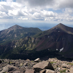
- Views of the San Francisco Peaks and neighboring volcanoes from the top of the hill
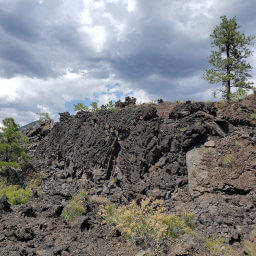
- Seeing the Bonito Lava Flow from above
Hike Summary
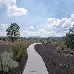
The hike to Lenox Crater is short albeit scenic. No matter when you visit, you can enjoy the quiet splendor of the pine forest covering the geologically interesting volcanic field. Visit this park and hike to Lenox Crater next time you're in Flagstaff and you won't be disappointed!
To start the hike, walk across the road from the parking area and look for the trailhead marker. The trail forms a loop, and you can choose to go in either direction -- I will describe the route going counterclockwise. Almost immediately after starting, you will begin ascending a gradual couple hundred feet to the top of the hill. Pine trees surround you, and you'll hear the consistent wind rushing through the millions of pine needles above you. In the spring and summer, you will find occasional wildflowers adding a splash of color to the earth-toned landscape, like the purple Sunset Crater Beardtongue pictured below, a flower only found in these volcanic fields.

Purple wildflowers decorating the pine forest

The San Francisco Peaks looming high in the distance

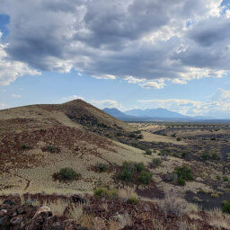
Sunset Crater from the trail
Important Information
Dogs are not allowed on any trails in the park; it's best to leave your dog at home since desert temperatures can kill dogs waiting in cars. The uphill climb at 7000 feet of elevation makes this a more difficult hike for families, but it's doable for most. You can visit during any season, but be prepared for wind. In the summer, temperatures can exceed 100 degrees and afternoon thunderstorms are common. Winter and early spring may bring snow, but it doesn't usually stick around long. The hill may deter some, but still expect to see people on the weekends.
Directions
From Flagstaff, take Interstate 40 east. Take the exit for U.S. Highway 89, then turn left. Turn right onto U.S. Highway 89. Turn right at the brown sign pointing to Sunset Crater Volcano National Monument and Wupatki National Monument. After passing the visitor center, look for a small parking area on the left hand side of the road. If this lot is full, continue straight then take the first right into the parking area for the Lava Flow Trail -- you'll have to take a short spur trail to reach Lenox Crater.
Google Maps Directions
Parking, Fees, and Facilities
Entrance to the park is $25 per vehicle and permits access for 7 days to both Wupatki National Monument and Sunset Crater Volcano National Monument. Interagency passes are also honored here. Visit the park's fees page for more information. There are no facilities at the trailhead, but there are pit toilets at the nearby parking for the Lava Flow Trail. Otherwise, the staffed visitor center has restrooms and water in addition to educational exhibits and a gift shop.
Nearby Hikes
Sunset Crater Volcano National Monument, Arizona
★★★☆☆(3/5)
Sunset Crater Volcano National Monument, Arizona
★★★☆☆(3/5)
Coconino National Forest, Arizona
★★★★★(5/5)
Coconino National Forest, Arizona
★★★★☆(4/5)