| Rating | ★★★★★(5/5) |
| Overall Difficulty | Very hard |
| Navigation Difficulty | Medium |
| Distance | 10.4 miles roundtrip |
| Time | 10 hours |
| Terrain | Strenuous Climbing, 4200 feet of elevation gain |
| Best Seasons | Spring, Summer, Fall |
| Family Friendly | No |
| Dog Friendly | No |
| Accessible | No |
Highlights
- Views from the highest peak in Maine
- The crystal clear waters of Katahdin Stream Falls
- Fun scrambling on boulders
Hike Summary
Though Mount Katahdin is lower in elevation than Nebraska's highpoint by about 160 feet, the hike to the top is no joke. With over 4,000 feet of elevation gain with 5.2 miles to reach the 5,267-foot summit, your legs are in for a workout! (I'd almost compare the difficulty of this hike with Mt. Humphreys in Arizona, except Mt. Katahdin is less than half as high). Most of the hike is above treeline, so you'll enjoy every break you take as you gaze across Maine's largest wilderness. This is a destination you shouldn't miss, especially if you enjoy climbing mountains.
The Hunt Trail coincides with the final segment of the Appalachian Trail (there's nothing like ending a thru-hike by climbing a mountain and having to climb back down). As such, the trail is well-marked, well-maintained, and well-traveled. From the parking lot, you'll follow a wide path through the campsite until you reach the trailhead marker. Be sure to sign the trail register located on the left so park rangers can know who is on the trail for emergency purposes! The climb begins gradually as you walk over tree roots and rocks, as pictured below. You can hear Katahdin Stream to your right with occasional glimpses of the water between the trees.

Twisted roots and mossy rocks are frequent obstacles on this section of the Appalachian Trail

The sparkling clear water of Katahdin Stream
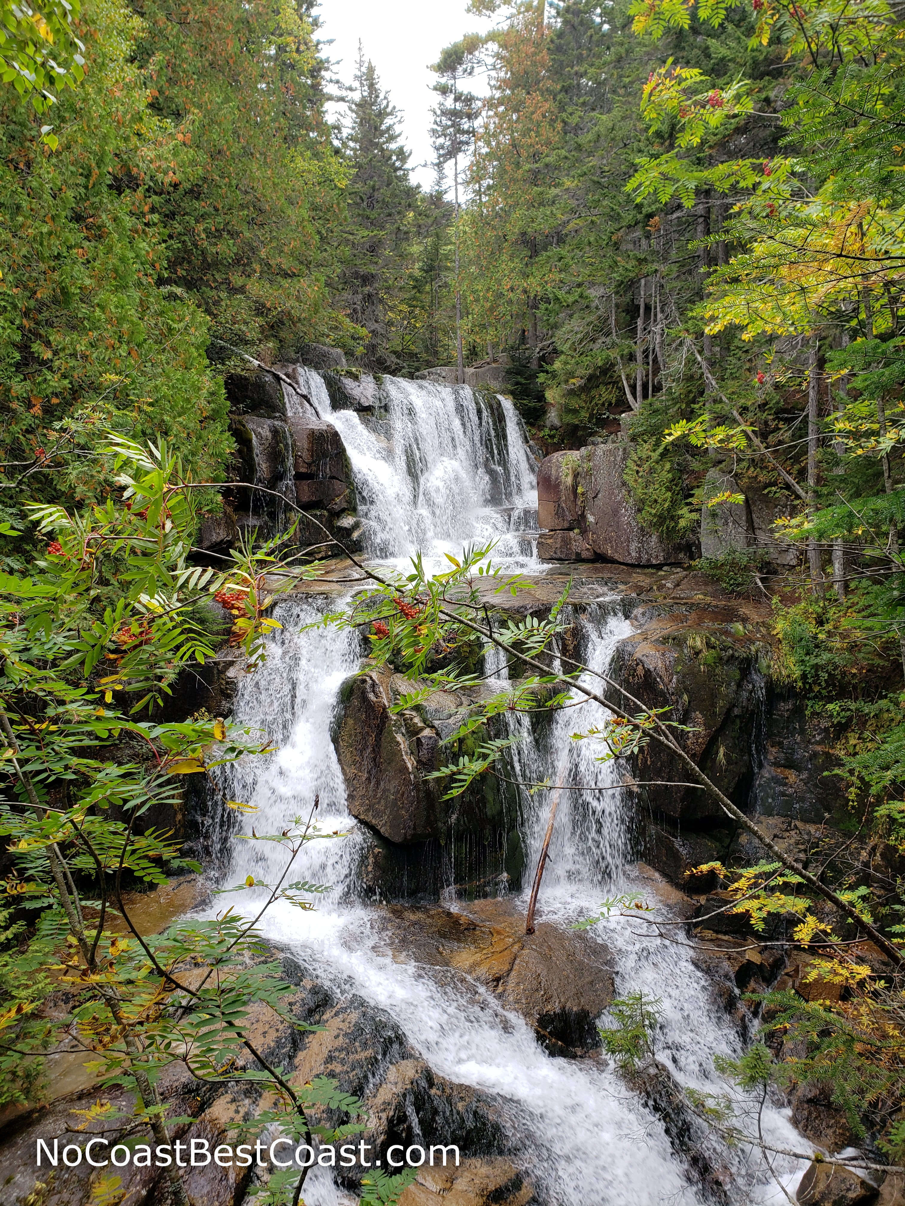
The gorgeous Katahdin Stream Falls is about a mile from the trailhead
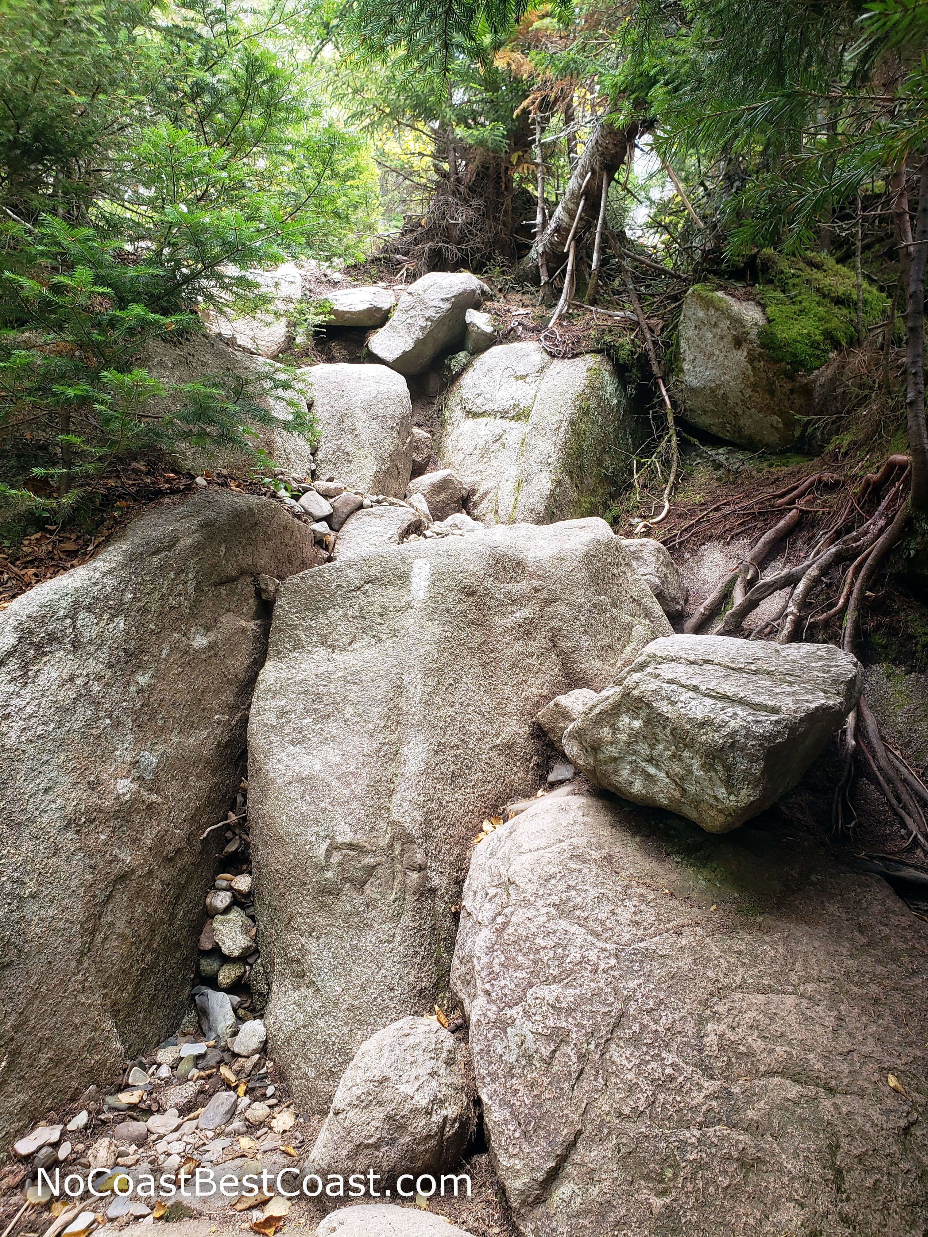
You'll have to climb up many boulders like these on this steep trail
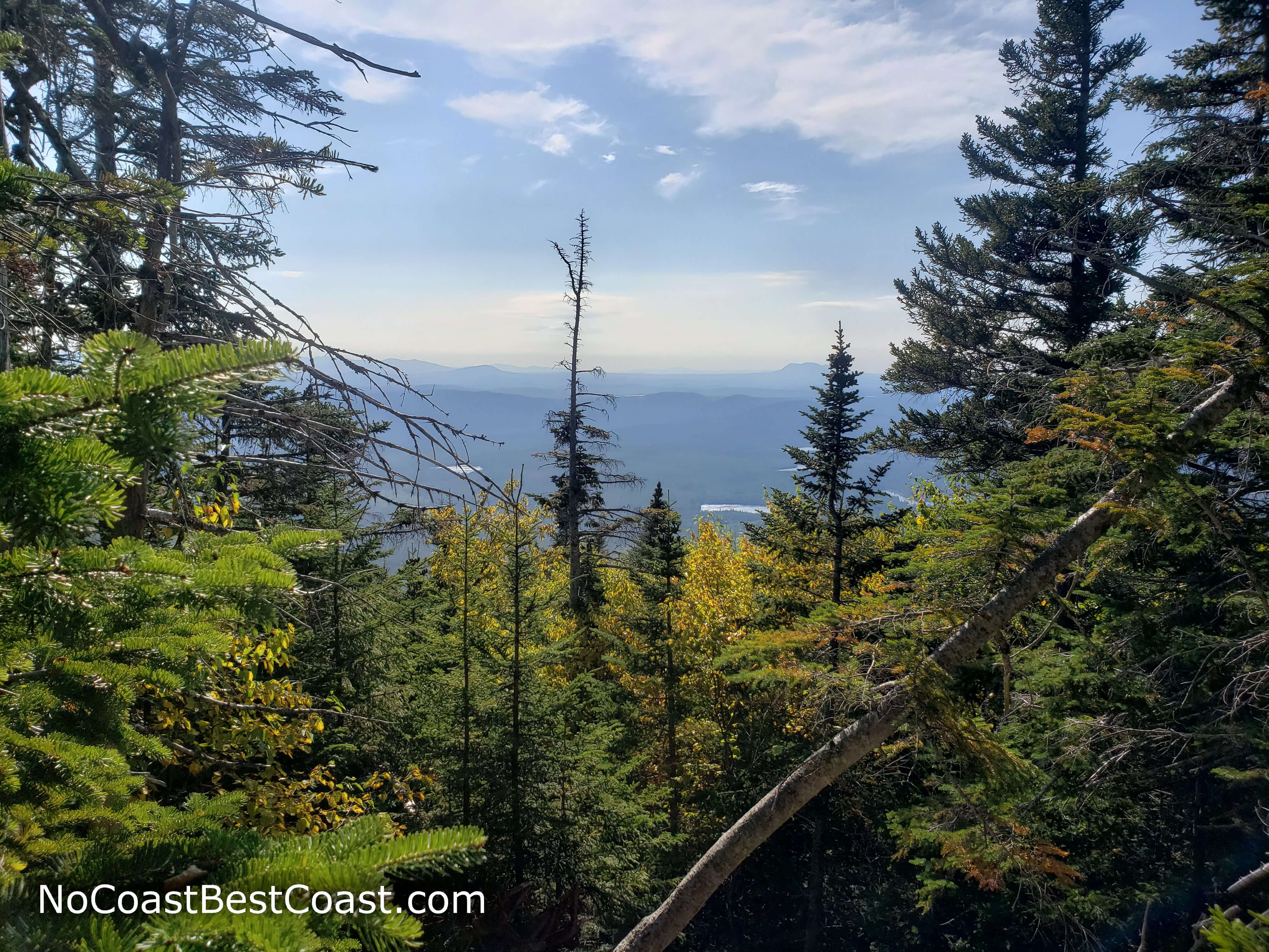
A gap in the trees hints at the views to come
Once above treeline, you'll have stunning views of the Appalachians
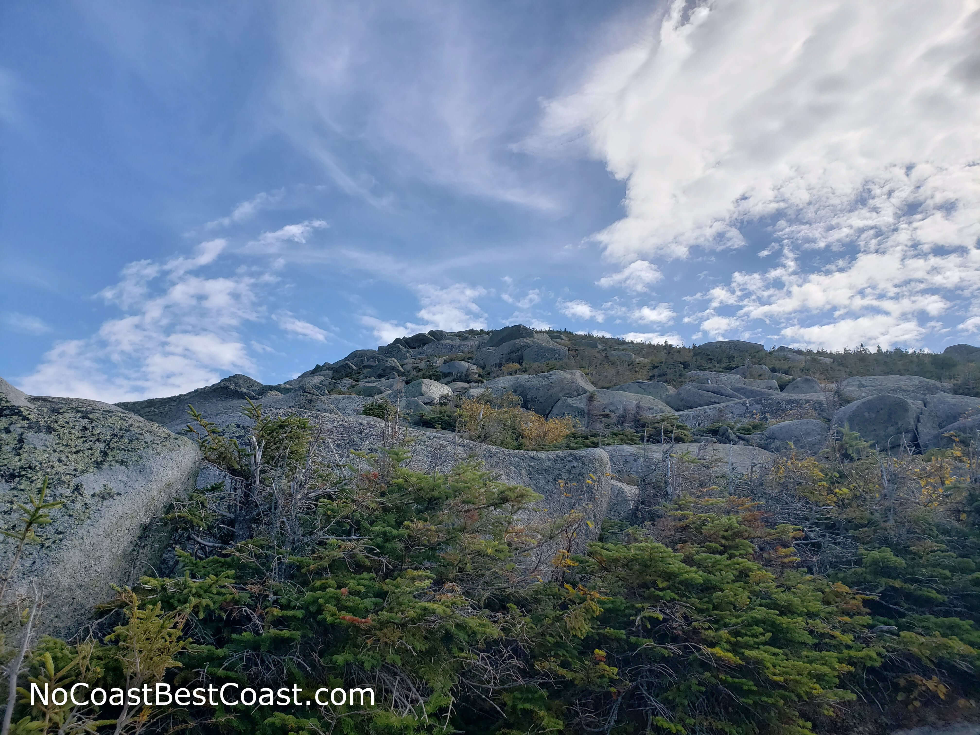
Looking up at the first of many false summits
The jagged ridgeline of Hunt Spur
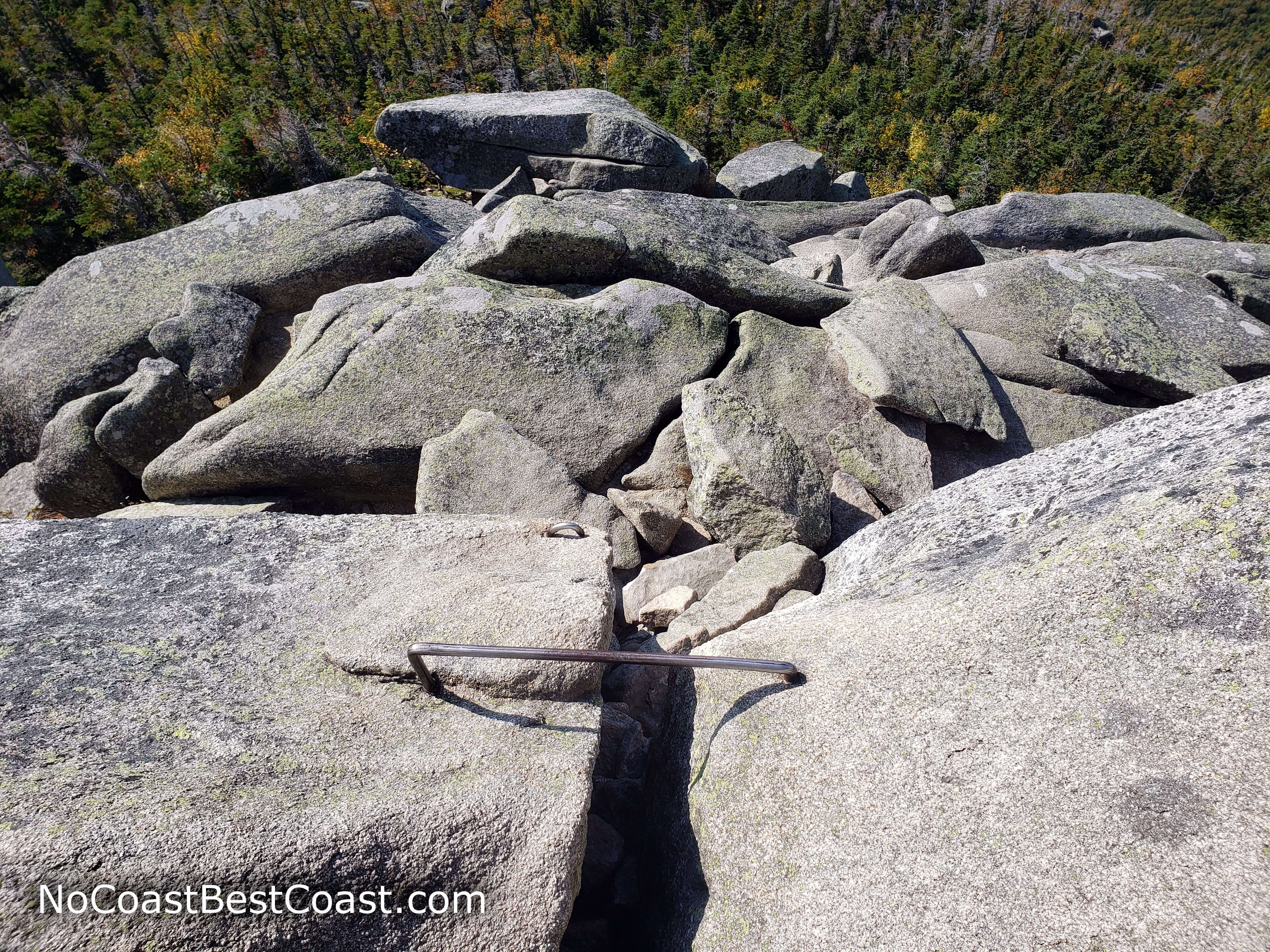
In some places, metal bars help you up and down particularly steep rocks
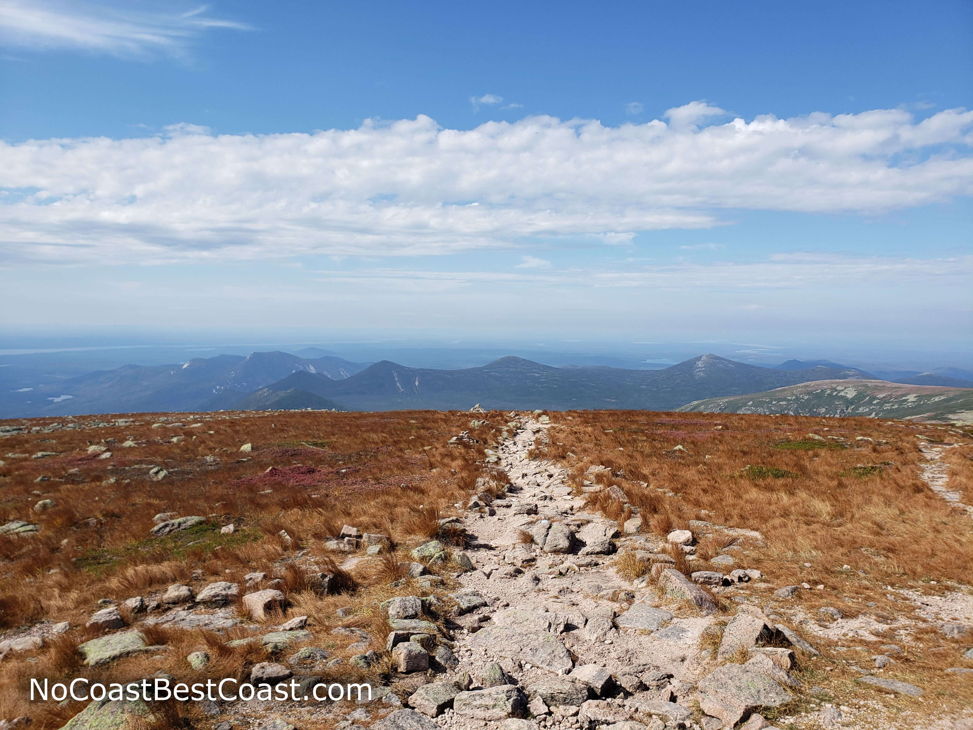
The alpine grasses of the Tableland
The remainder of the climb follows a series of stone steps punctuated by large rocks. The trail is steep, but it's nothing compared to what you hiked earlier. You may start to feel the effects of altitude now that you approach a mile above sea level, but it's pretty minimal compared to what you may have experienced climbing western peaks.
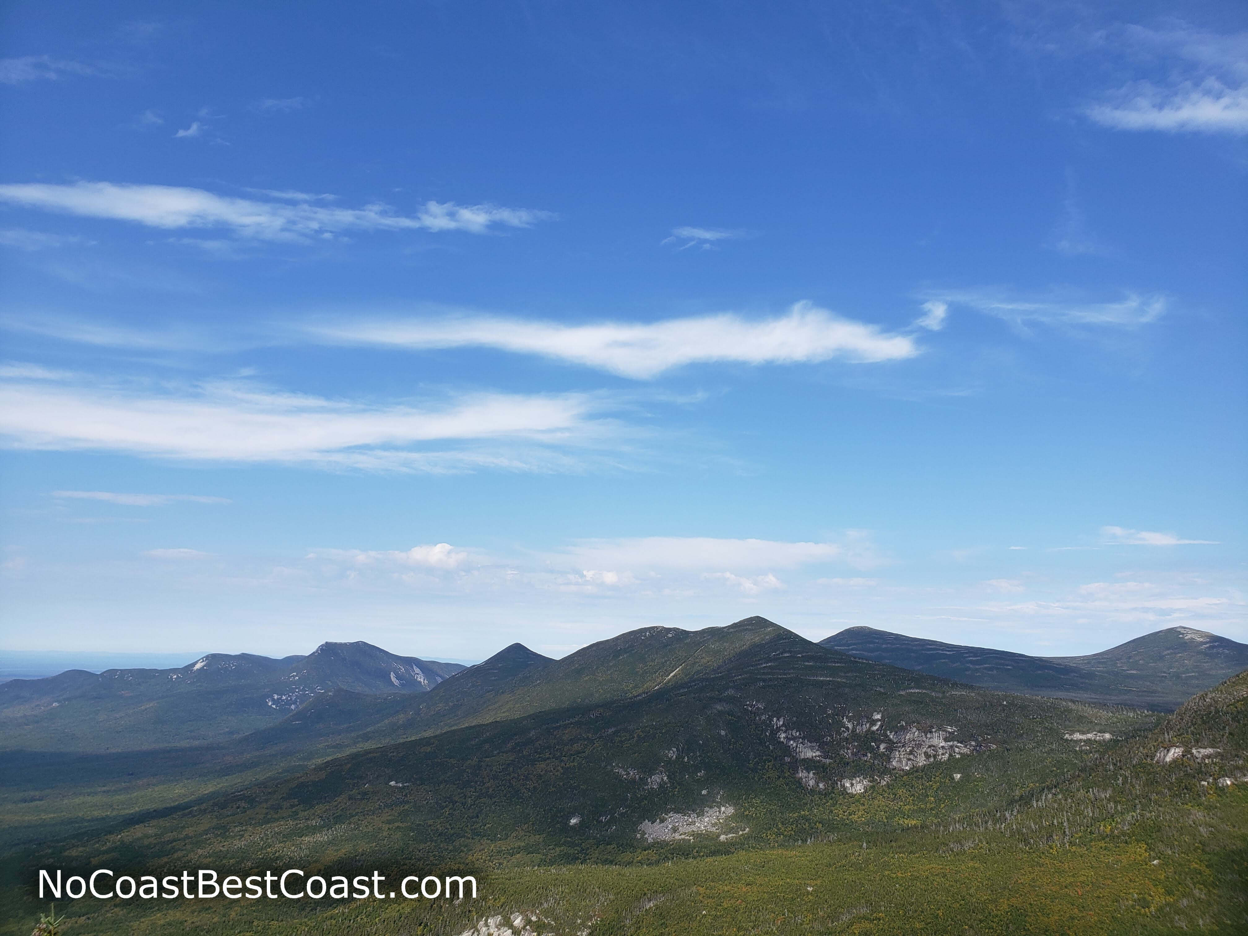
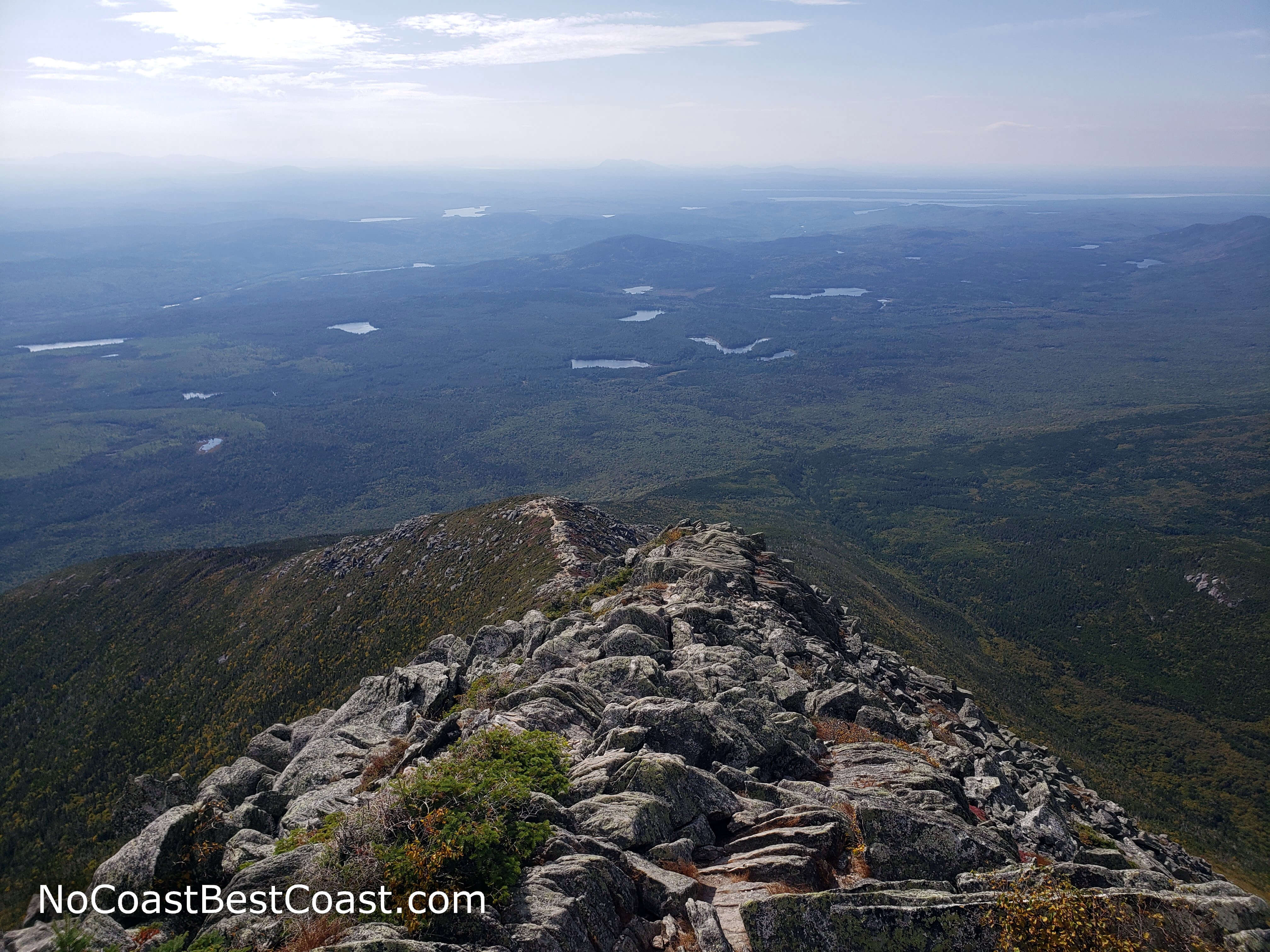
A wooden sign and a massive stone cairn greet you at the top, along with several other tired hikers. To the east, you'll have your first view of the other side of the mountain towards Pamola Peak and Chimney Pond, as shown in the first picture below. To the southeast, you can peer down Knife Edge (in the second picture below), the most challenging route to the summit, which involves steeper climbing than on Hunt Spur with the added danger of steep drops on either side. To the south and west, you can see the endless green land of lakes and mountains as they stretch to the horizon, as shown in the third picture below.
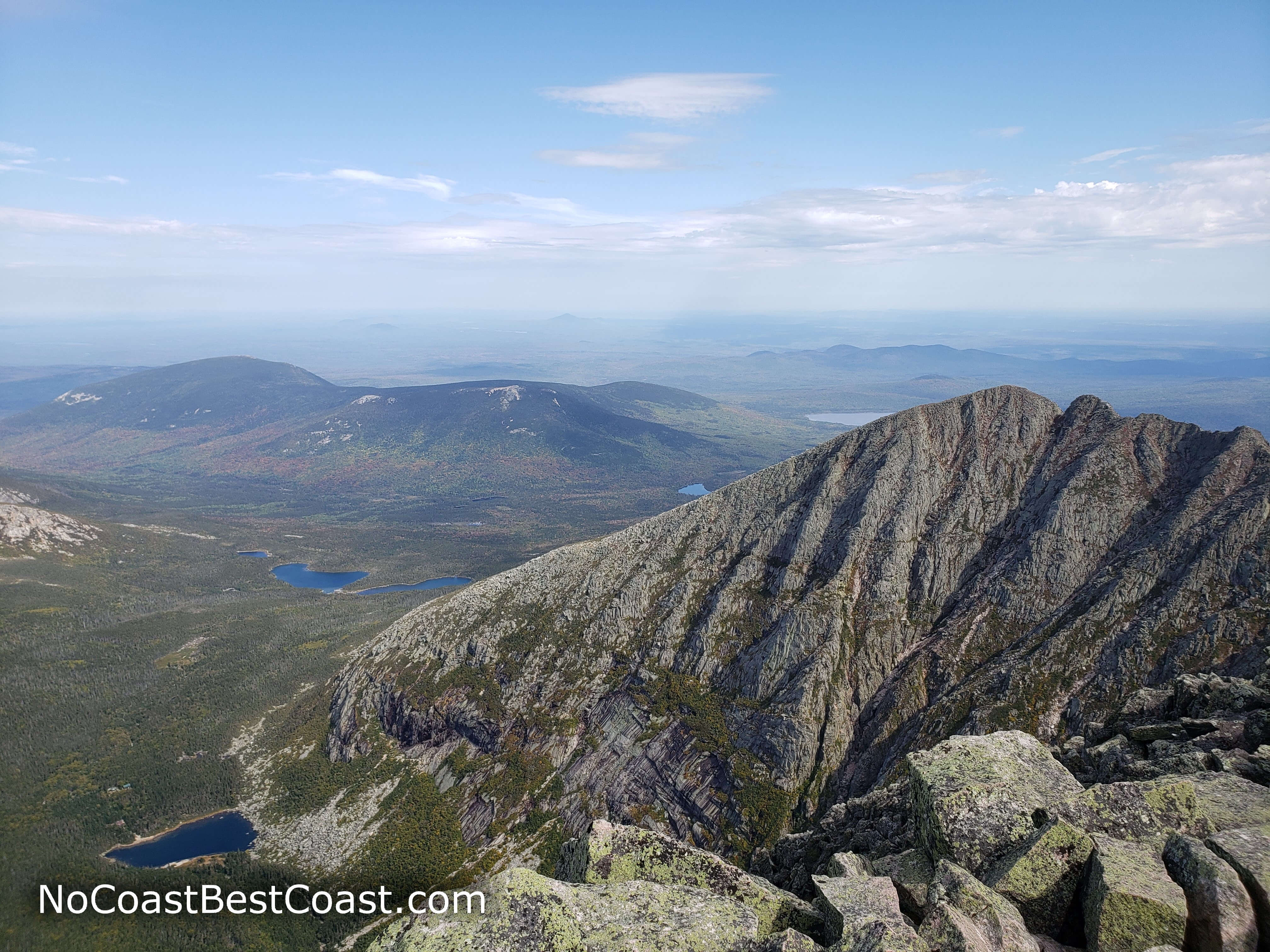
Pamola Peak and Chimney Pond to the east of the summit
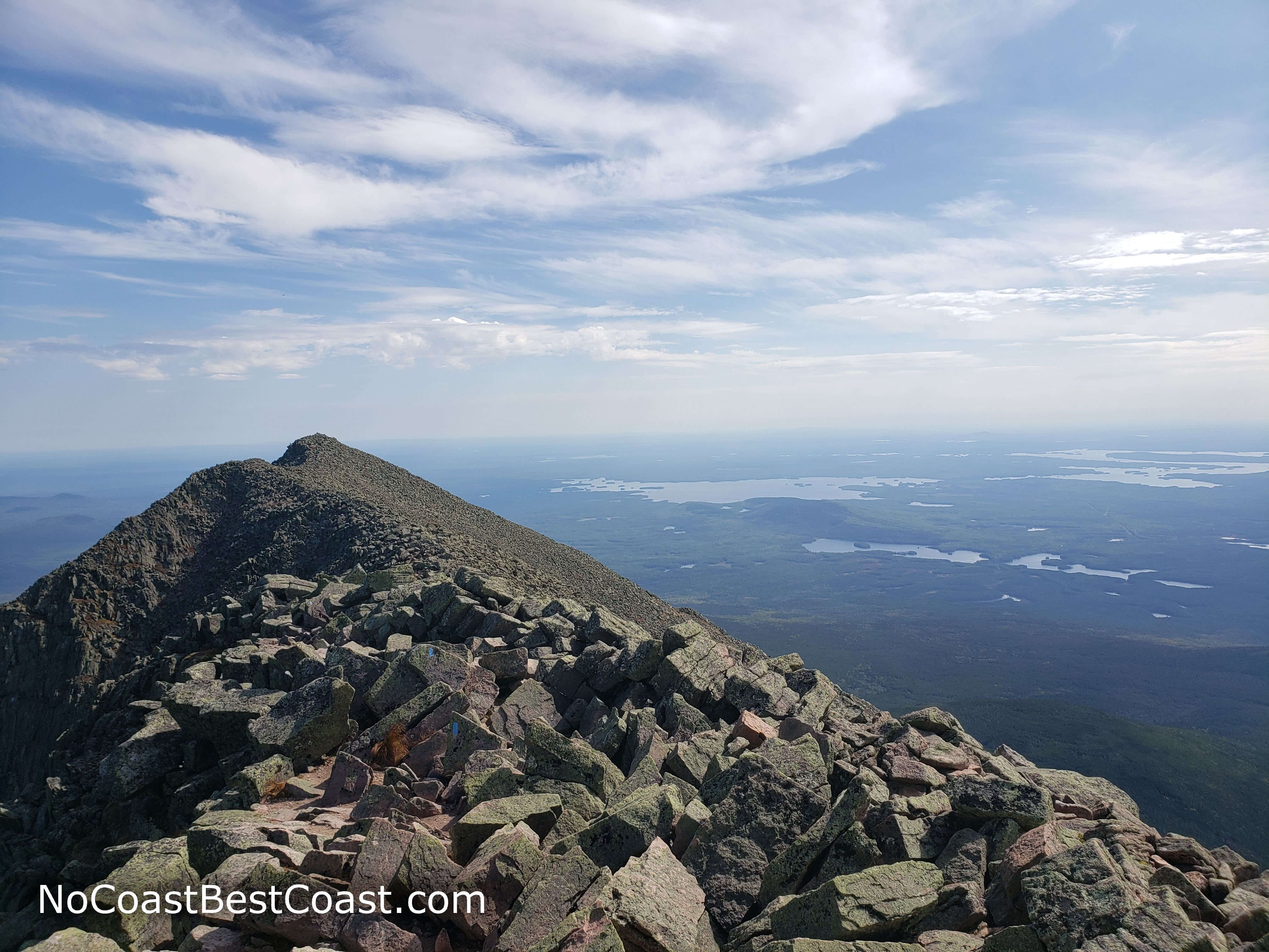
The sharp rocks leading down Knife Edge
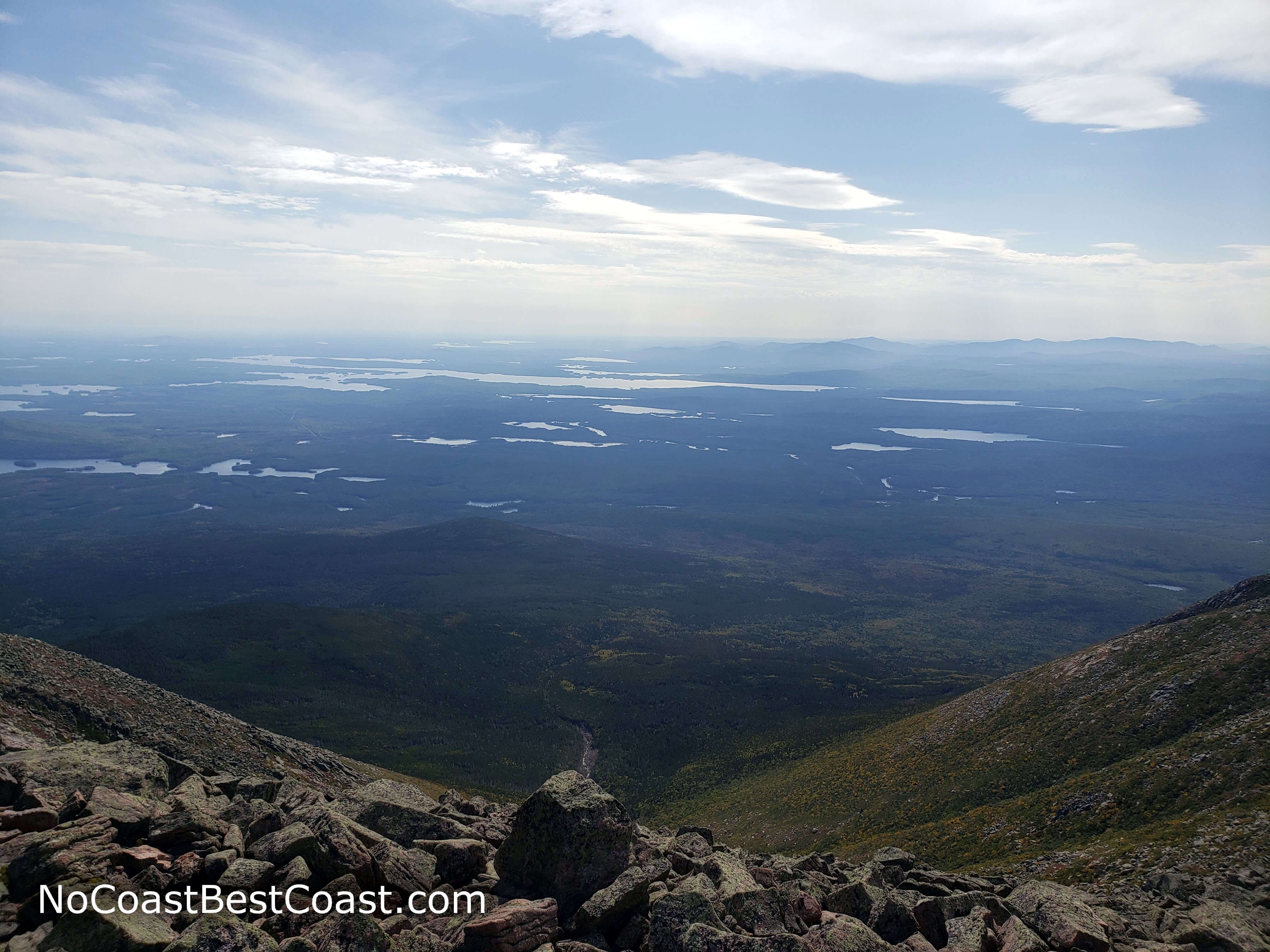
Looking south from the summit at the many lakes and distant mountains of Maine
Undoubtedly, this hike was one of my highlights for 2019. Words cannot describe the beauty of this hike, and I strongly encourage you to try this peak for yourself. Connect with me using the social media links below and share your adventures!
Important Information
In order to preserve the wilderness character of the park, dogs are not allowed. This rugged, steep, long-distance trail is not suitable for children; instead, hike with kids to Cranberry Pond or Caverly Pond. Group size is limited to 12 people.
Climb Mount Katahdin during the three warmer seasons; a winter trek typically requires snowshoes and is very difficult to do in one day. No matter which season you hike, the 5200-foot summit will be around 15 degrees cooler, so bring a jacket or sweater even in the summer. The park mandates that hikers must carry a flashlight or headlamp.
The Hunt Trail as well as all other routes to the summit of Mount Katahdin are extremely popular hikes. You can reserve a parking spot for $5 on the Baxter State Park reservations page up to two weeks before your hike (plan months in advance if you intend on going on a summer weekend) -- note that you must input a license plate number, which makes reservations impossible if you plan on driving a rental car. After 7am, parking reservations expire and rangers allow cars in on a first-come, first-served basis until each lot is full. Though many people hike this trail, the limit of parking spaces ensure that you will enjoy solitude for most of the hike (until you reach the generally crowded summit).
Directions
Baxter State Park is about 5 hours from Boston. Take Interstate 95 North for about 4 and a half hours, then take the exit for Maine Highway 157. Turn left and continue straight until you reach the town of Millnocket. Once in town, there are signs indicating the turns for Baxter State Park. Turn right onto Katahdin Avenue, then turn left onto Bates Street. Continue straight until you reach the park entrance station. Pay the fee if necessary, then turn left at the fork. Turn right at the sign for Katahdin Stream Campground and park in the day use parking lot on the left -- note that from the entrance station to the parking lot, it takes about half an hour due to the slow speed limit on the dirt road.
Google Maps Directions
Parking, Fees, and Facilities
Parking is free for all Maine residents. Non-residents must pay for a $15 gate pass (or $40 for an annual pass); cash is preferred due to slow internet processing time, but cards are accepted. You can also buy your pass ahead of time on the Baxter State Park reservations page. There are pit toilets near the lot, but you must bring all your own water or treat the water from Katahdin Stream.