| Rating |
★★★★★(5/5) |
| Overall Difficulty |
Very hard |
| Navigation Difficulty |
Easy |
| Distance |
14 miles roundtrip |
| Time |
8 hours |
| Terrain |
Strenuous climbing, 4400 feet of elevation gain |
| Best Seasons |
Summer, Fall |
| Family Friendly |
No |
| Dog Friendly |
Yes |
| Accessible |
No |
Highlights
- Panoramic views from the highest peak in New Mexico
- Stunning alpine scenery
- Beautiful meadows and pine forest
Hike Summary
Wheeler Peak is the tallest mountain in New Mexico and the 8th tallest state highpoint, rising 13,161 feet above sea level. Even without those distinctions, this is a fantastic climb and was one of my favorite hikes of 2020. While most people take the Williams Lake Trail to summit Wheeler Peak since it's the shortest route, it's worth it to take your time and do the alternative route up the Bull-of-the-Woods Trail. The trail from Williams Lake to the summit is no-nonsense with little aesthetic variety and a painful amount of switchbacks. The shorter distance of that trail also means that it's steeper, which makes the climb into thin air feel much more difficult. The worst part of the Williams Lake Trail is that it is absolutely packed, or at least it will feel that way once you're above treeline and you can see group after group switchbacking up the mountain above and below you.
Doing both trails as a loop isn't easy, however. The route between the two trailheads involves wandering the roads of Taos Ski Valley since there isn't a real connecting trail. The best way to do the loop would be to have two cars, either swapping keys with a friend and going opposite directions or parking one car and driving to the other trailhead -- either way reduces some hiking mileage as a bonus. If those aren't an option, park at the Williams Lake Trailhead and start your hike with the downhill jaunt to the Bull-of-the-Woods Trailhead. I unfortunately started at the Bull-of-the-Woods Trailhead and had to navigate the ski valley while exhausted and sick of downhill hiking. Moral of the story: don't leave the worst part of the hike for the end.
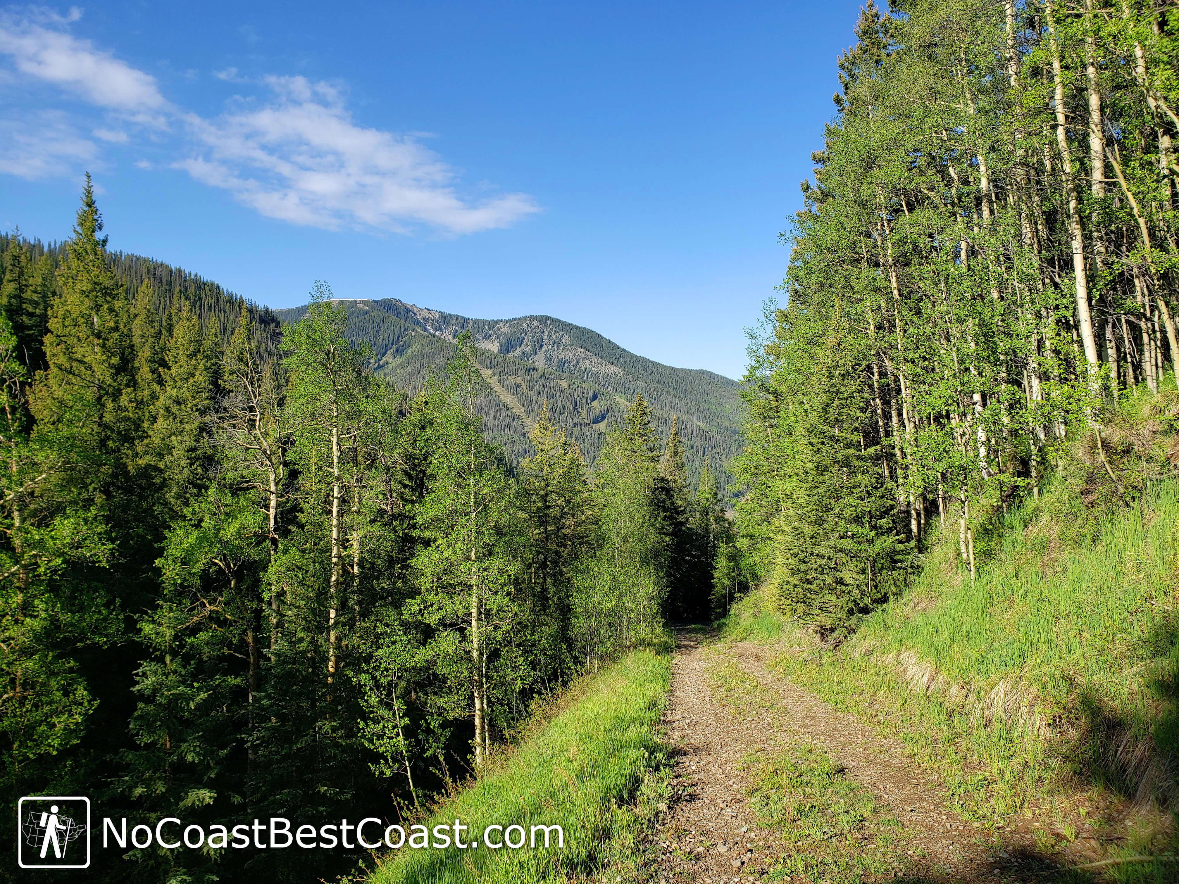
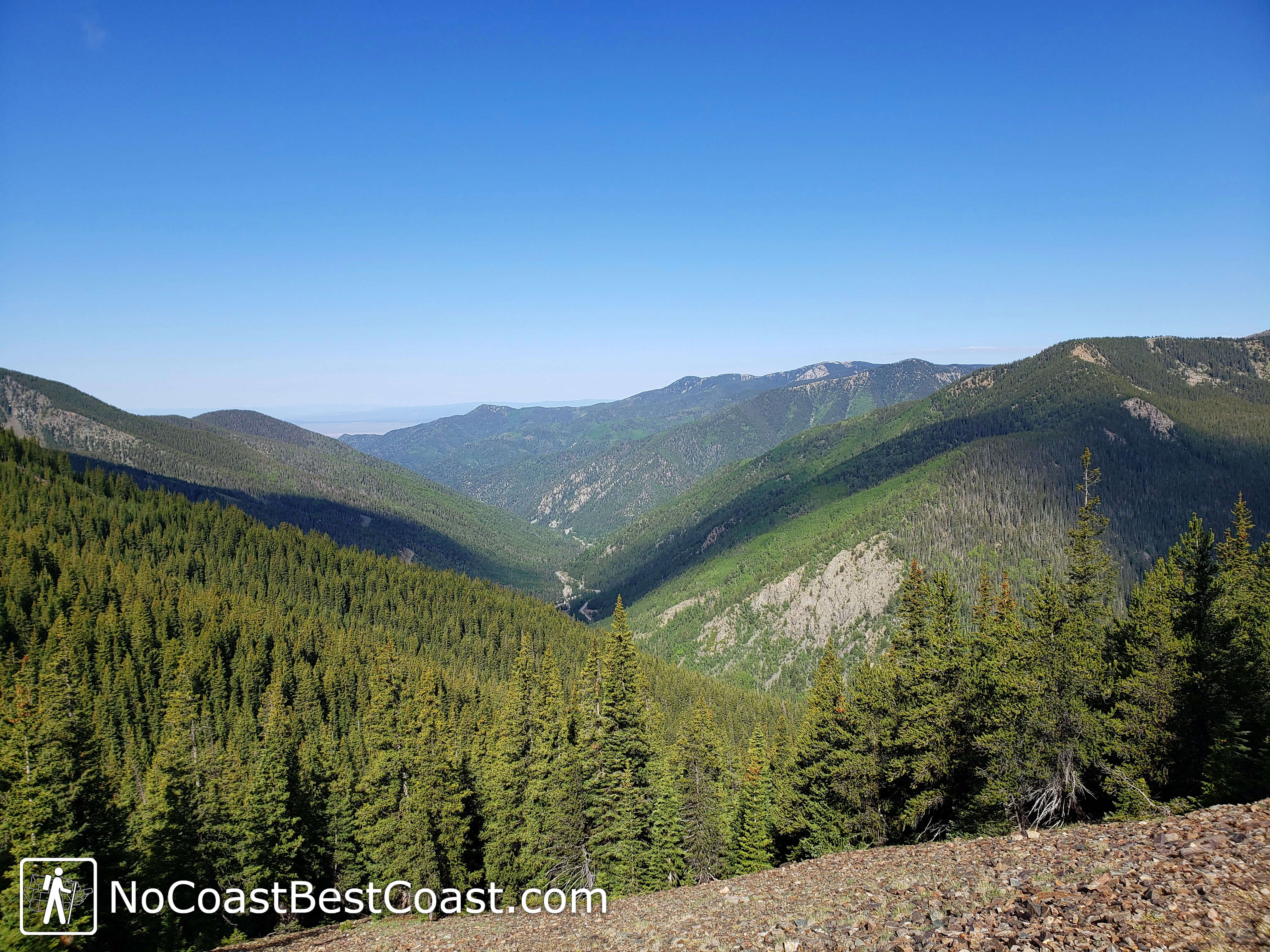
Assuming you took my advice, your hike will start by following the road you drove on back downhill. You can follow the road the entire way to the Bull-of-the-Woods Trailhead (which is more straightforward and harder to get lost), or you can take a trail labeled as Kachina Road on Google Maps by continuing past a gate preventing vehicular access. The latter route is a sunny, former road alongside a slope on the east side of the ski valley, giving you views like pictured below. At the end of this trail, one option is to follow the roads switchbacking down the mountain until you turn right onto Twining Road and follow that until the trailhead. The other option, which I chose, is to take shortcuts down the side of the hill between these switchbacking streets to save a couple steps. In any case, I recommend downloading this area as an offline map so you can refer to that if you get lost -- luckily the GPS on your phone still works even when you don't have cell service!

Kachina Road between the Williams Lake and Bull-of-the-Woods Trailheads with a nice view of the valley
Once you reach the Bull-of-the-Woods Trailhead, the remainder of your route will be well-signed. It's pretty much all uphill hiking from here on out, and this starting elevation of 9400 feet means you'll run of out breath much quicker than usual. The trail follows the left side of the creek pictured below, a lush, damp paradise compared to the New Mexican desert you just drove from.

Cascades alongside the Bull-of-the-Woods Trail
The initial part of the Bull-of-the-Woods Trail can be confusing since there is a parallel trail for equestrian use in addition to the narrower, slightly steeper hiking trail. You will come to places that seem like trail intersections, but they're actually just where the horse and hiking trails cross and will be marked as such. Don't stress too much about which version you're on -- they both lead to the same place in the end. About halfway to the Bull-of-the-Woods Pasture, you'll have to cross the creek you've been following. The closest thing to a bridge are the fallen logs spanning the creek, as pictured below. Later in the summer I suspect the water levels are much lower and this crossing is easier.
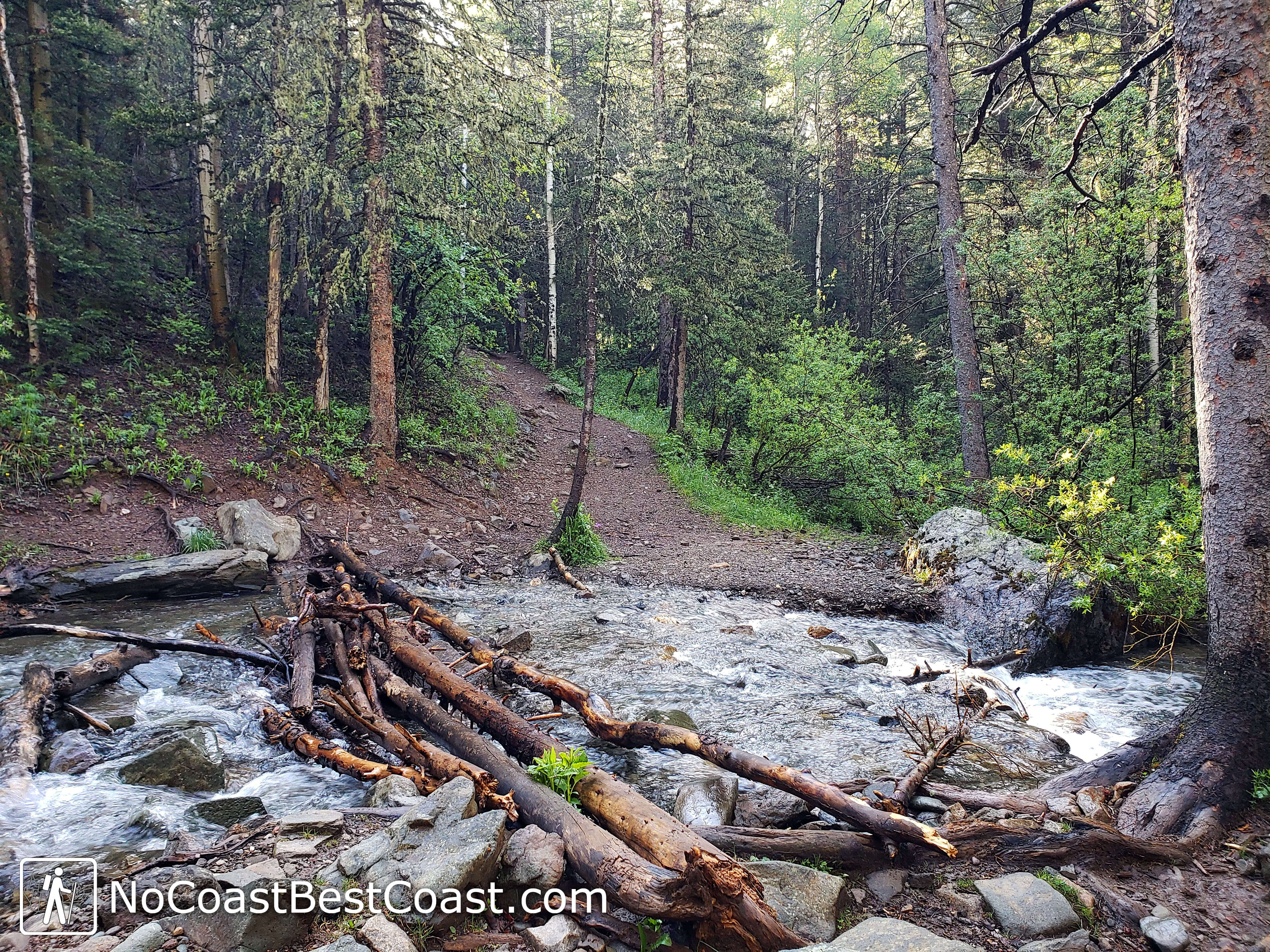
Logs to help you cross the creek
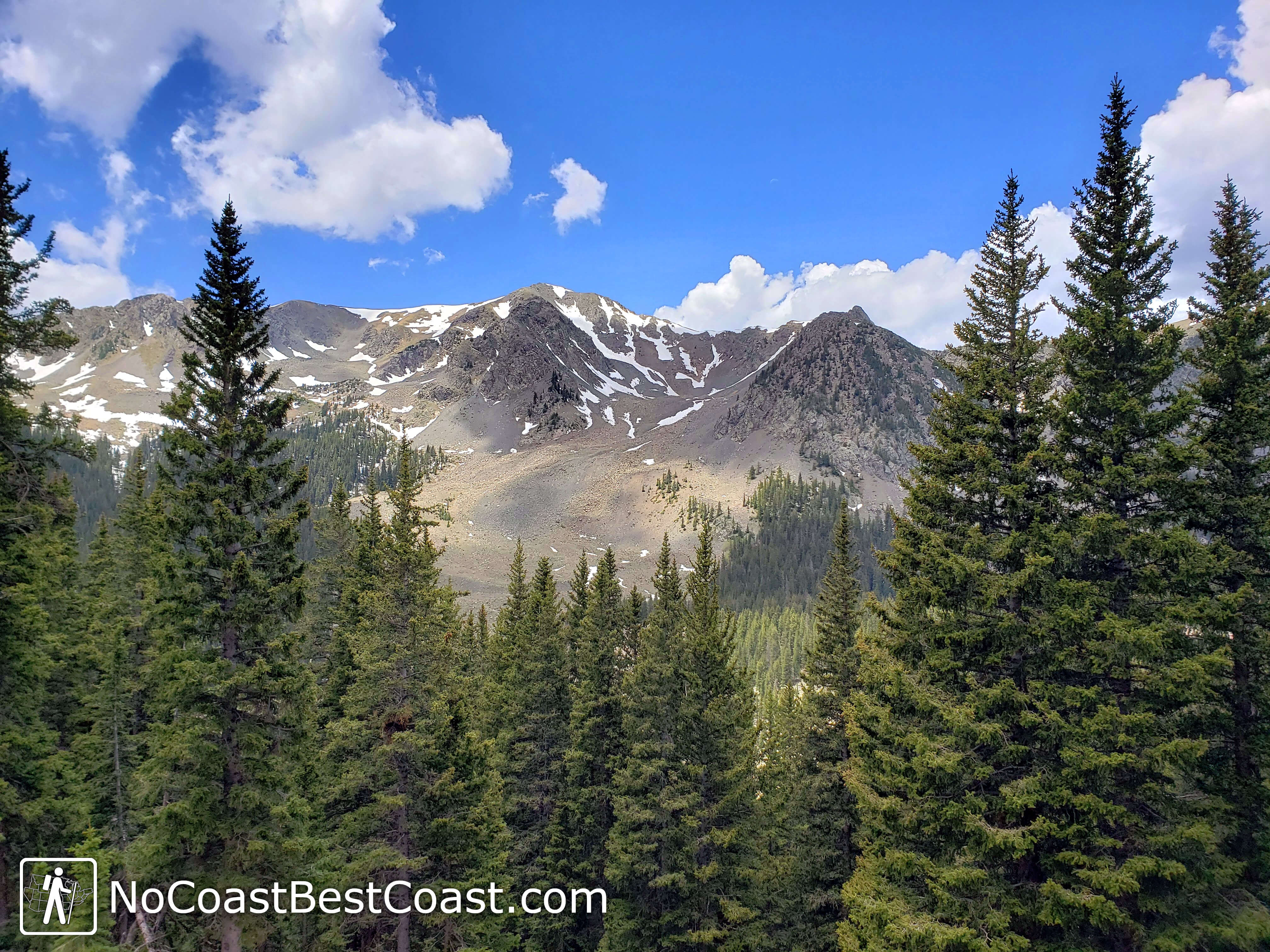
As you climb further, gaps in the trees begin to yield views of the valley and surrounding mountains, as pictured below. Slowly, the forest composition transitions from the ponderosa pine found at the bottom of the valley to more spruce, fir, and aspen.
The Bull-of-the-Woods Trail cutting through the forest
After about 2 miles and 1000 feet of elevation gain, you'll reach Bull-of-the-Woods Pasture, as pictured below, not far to the left of the main trail. This is the perfect place to stop and refuel before continuing your uphill journey. At this point, you're nearly at 11,000 feet above sea level, and it's likely you're really starting to feel the effects of high altitude (if you weren't already).
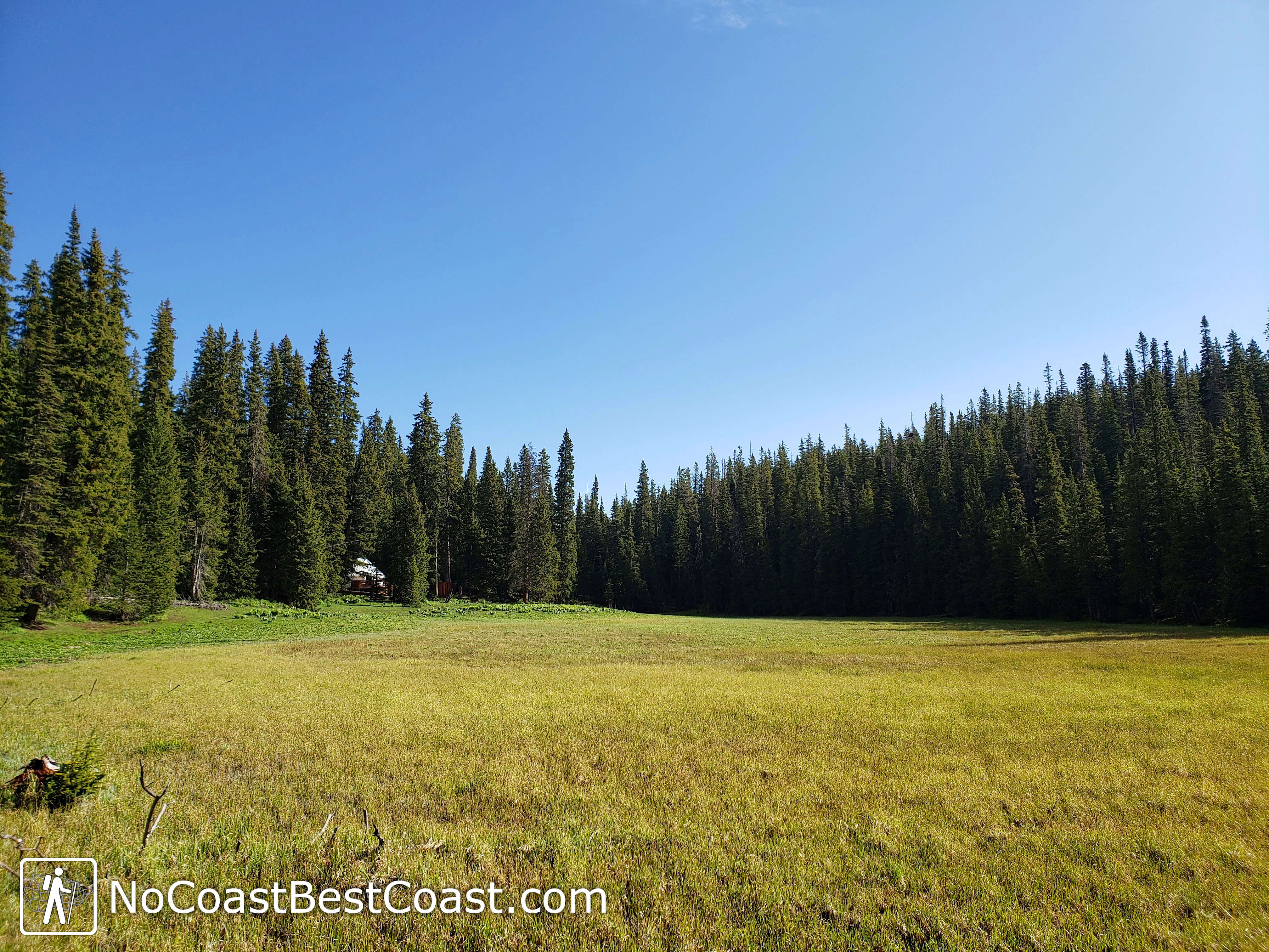
Bull-of-the-Woods Pasture, the namesake of the trail and an excellent spot to snack
Beyond Bull-of-the-Woods Pasture, there are a series of mountain bike trails that make navigation slightly more complicated. Stick to the wide, road-like trail to stay on track. Soon, you'll start reaping the rewards of your uphill effort with views of the valley like pictured below.
Taos Ski Valley from the Bull-of-the-Woods Trail
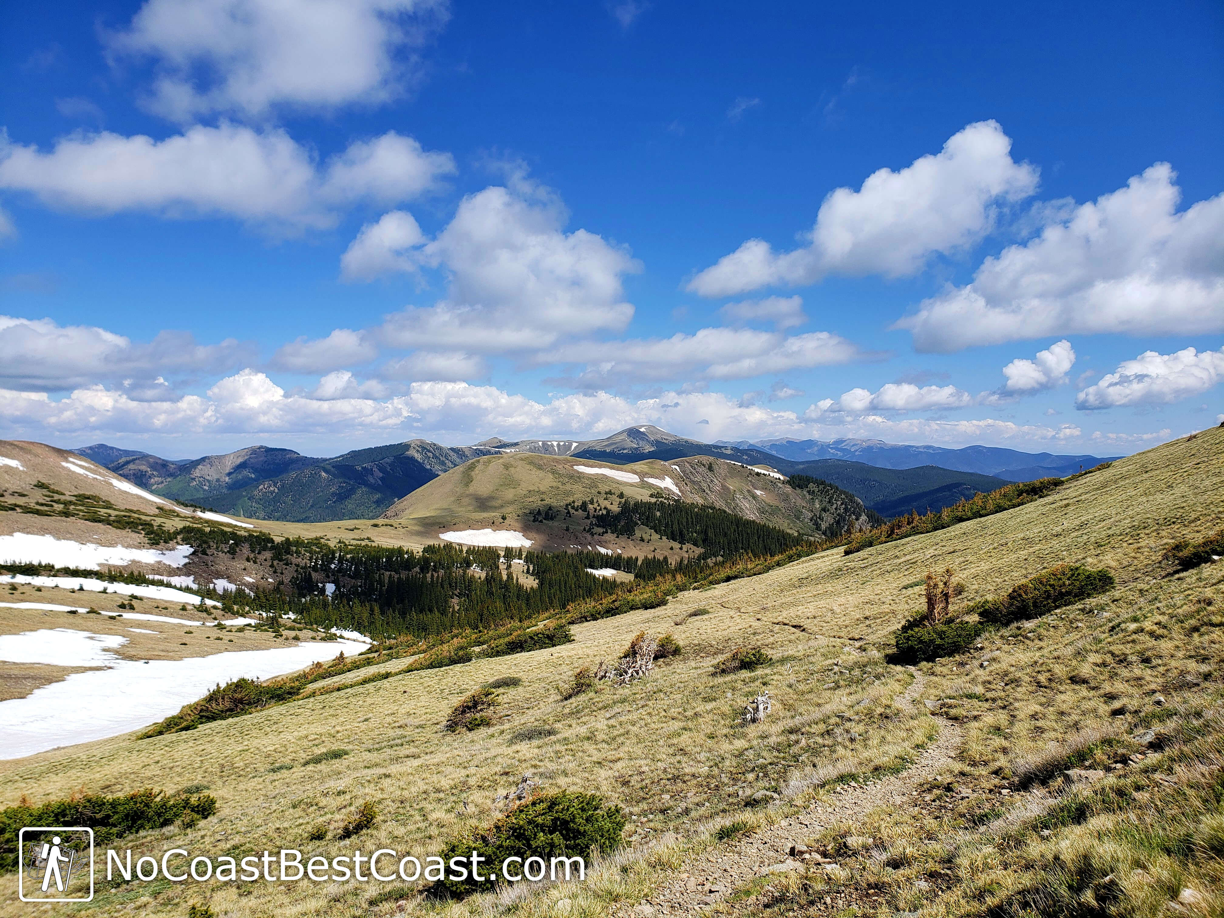
Higher up, the trees will start to shrink in height until they completely disappear, yielding massive grassy slopes and endless views, as pictured below. From here, start paying attention to the weather; if dark clouds start rolling in (a frequent afternoon occurrence), turn around and return below treeline to avoid lightning strikes. Eventually, the trail reaches an apex near the top of Frazier Mountain, right around 12,000 feet of elevation. You'll enjoy a short bout of downhill with your first major eastward views.
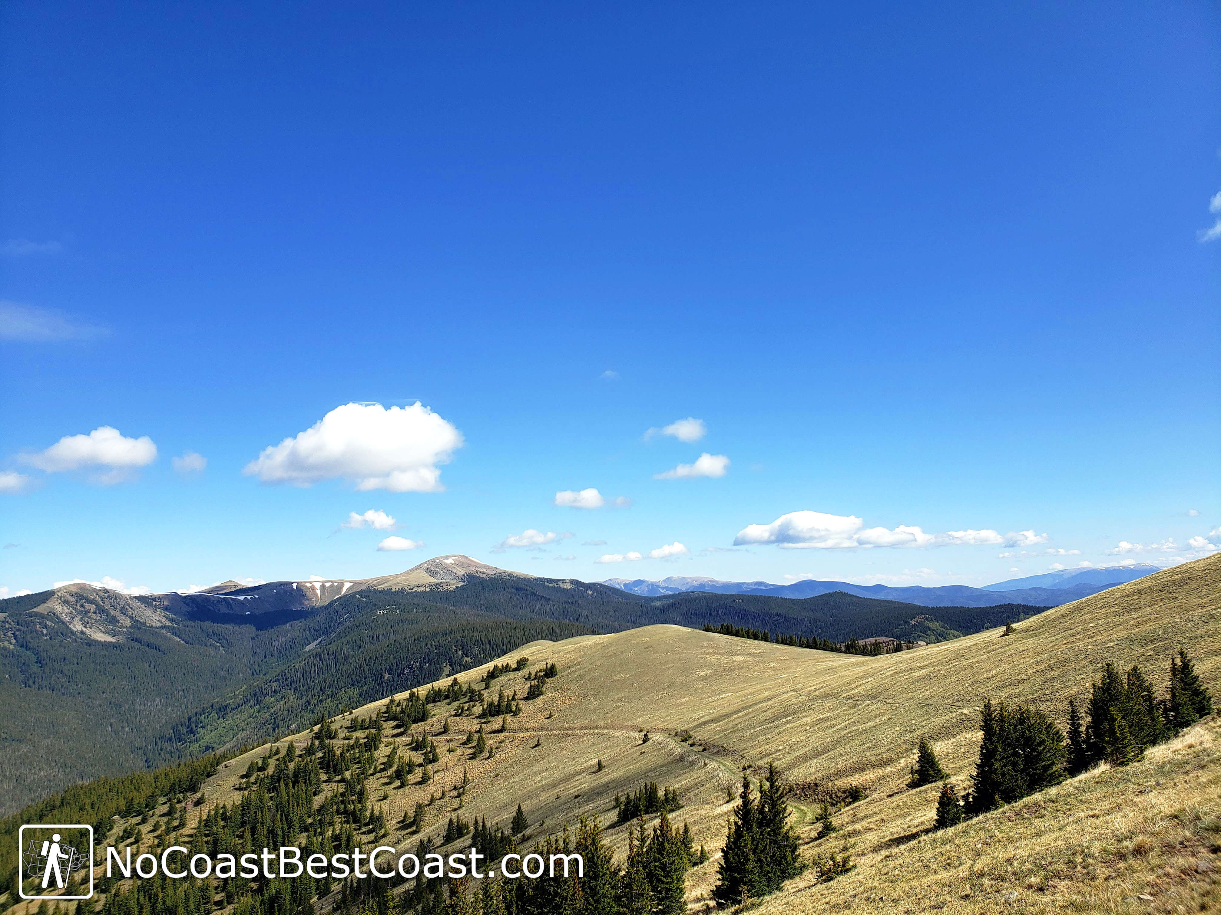
The trail above treeline with distant high peaks in the background
The downhill segment ends at a pleasant babbling brook in a forest grove, as pictured below. Snow lingers into the summer on the northern facing slopes. This is another nice spot to rest before continuing up another 1300 feet.
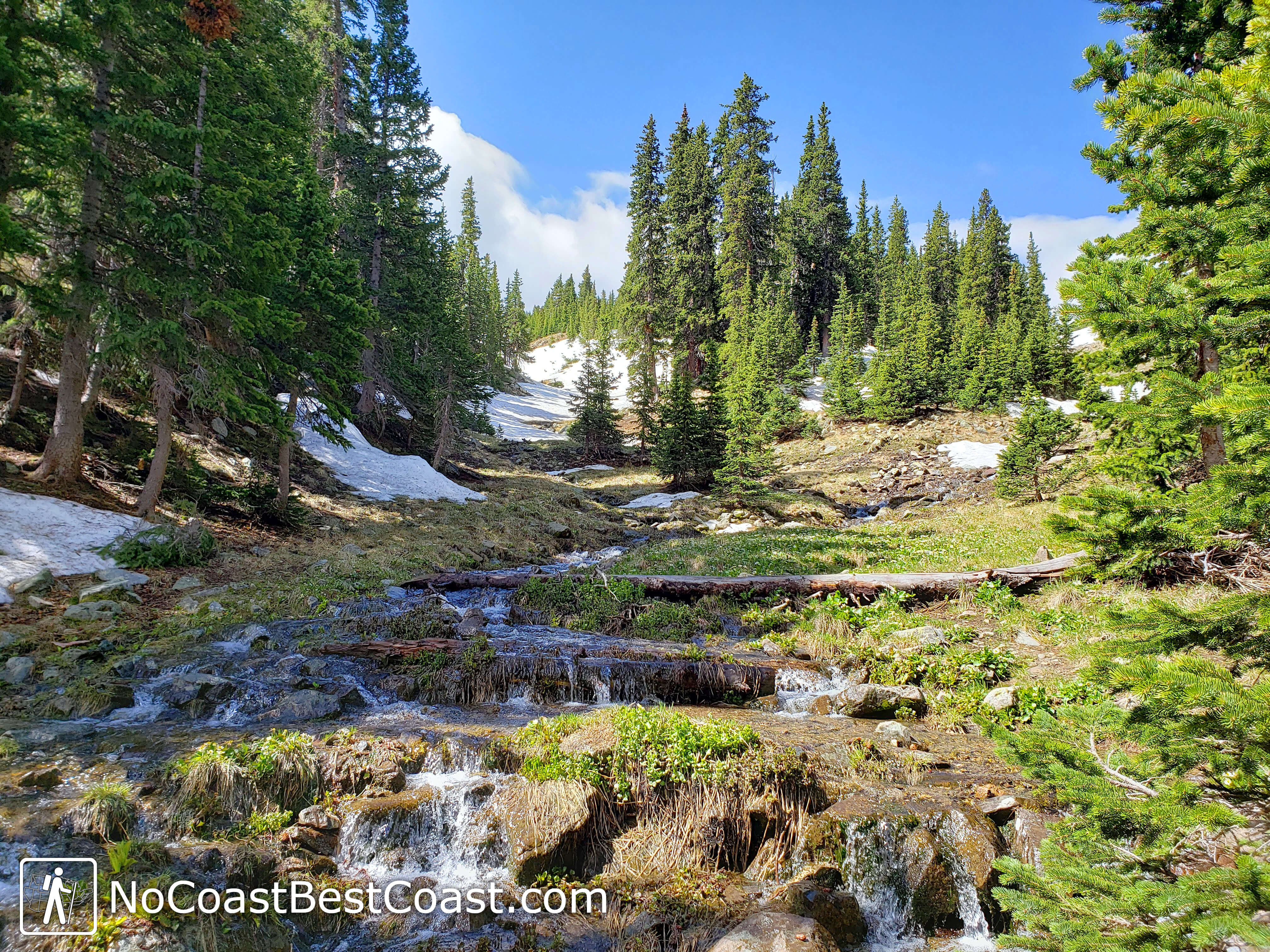
A fresh mountain stream before the final upward push
Depending on how early in the season you climb, snow may bury portions of the trail like pictured below. Should this happen, your best bet is to follow the footsteps of previous hikers. If you can't tell which way is right, keep heading uphill in a southerly direction and you should find the trail again. As a hiking buddy once told me, "Up is up!"
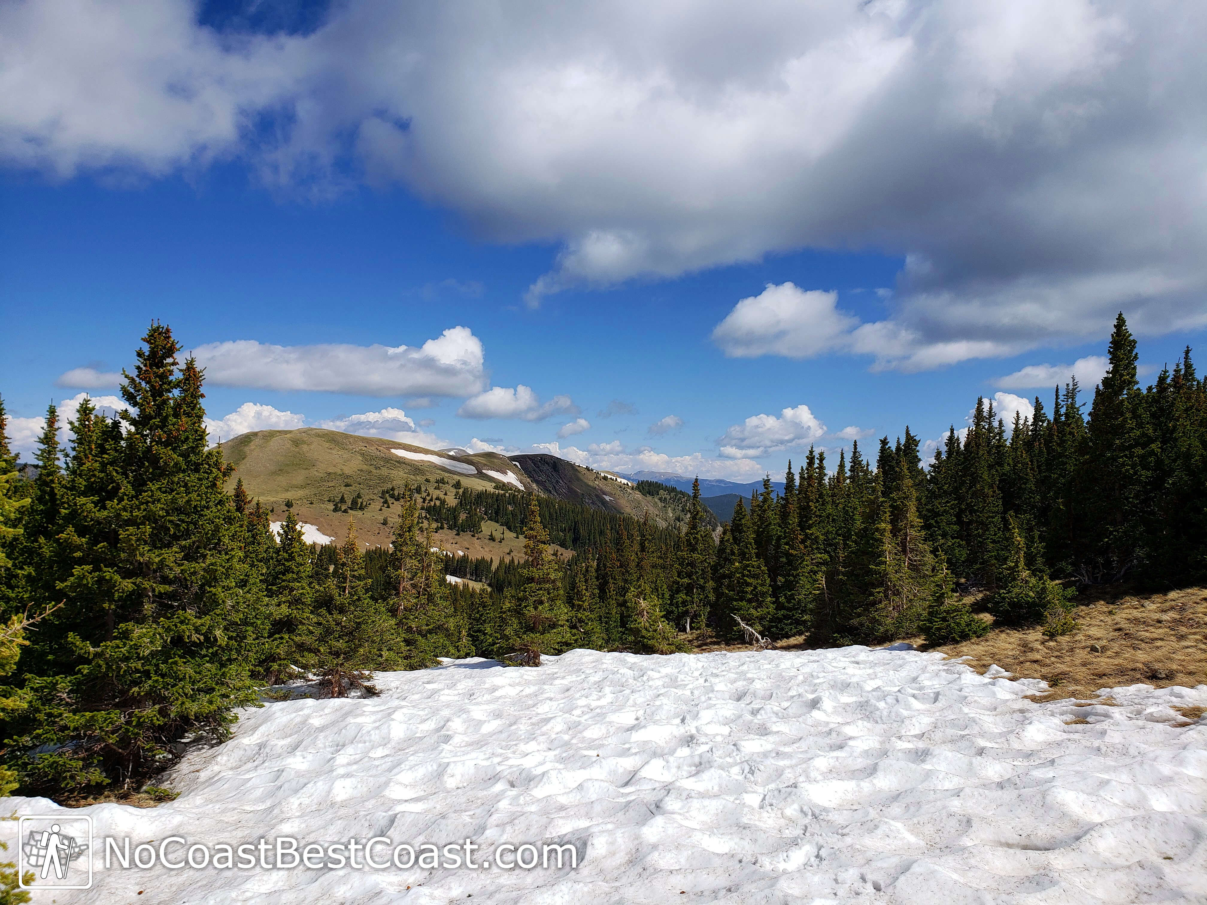
Snow covering the trail near 12,000 feet
The next section of trail is a long slog of switchbacks to the top of the final ridge of the climb. The altitude really makes this section difficult, but you won't mind stopping frequently to catch your breath with the views like pictured below. Lining the sides of the trail are rare alpine flowers, and if you're lucky you'll see a marmot or two scampering up and down the slopes.
Alpine views help you cope with the difficulty of climbing
Once you're high on the ridge, Wheeler Peak will come into view -- your final destination isn't much further now. The trail crosses the summit of an unnamed peak then over the top of Mount Walter, pictured below, which is the 2nd highest named peak in New Mexico.
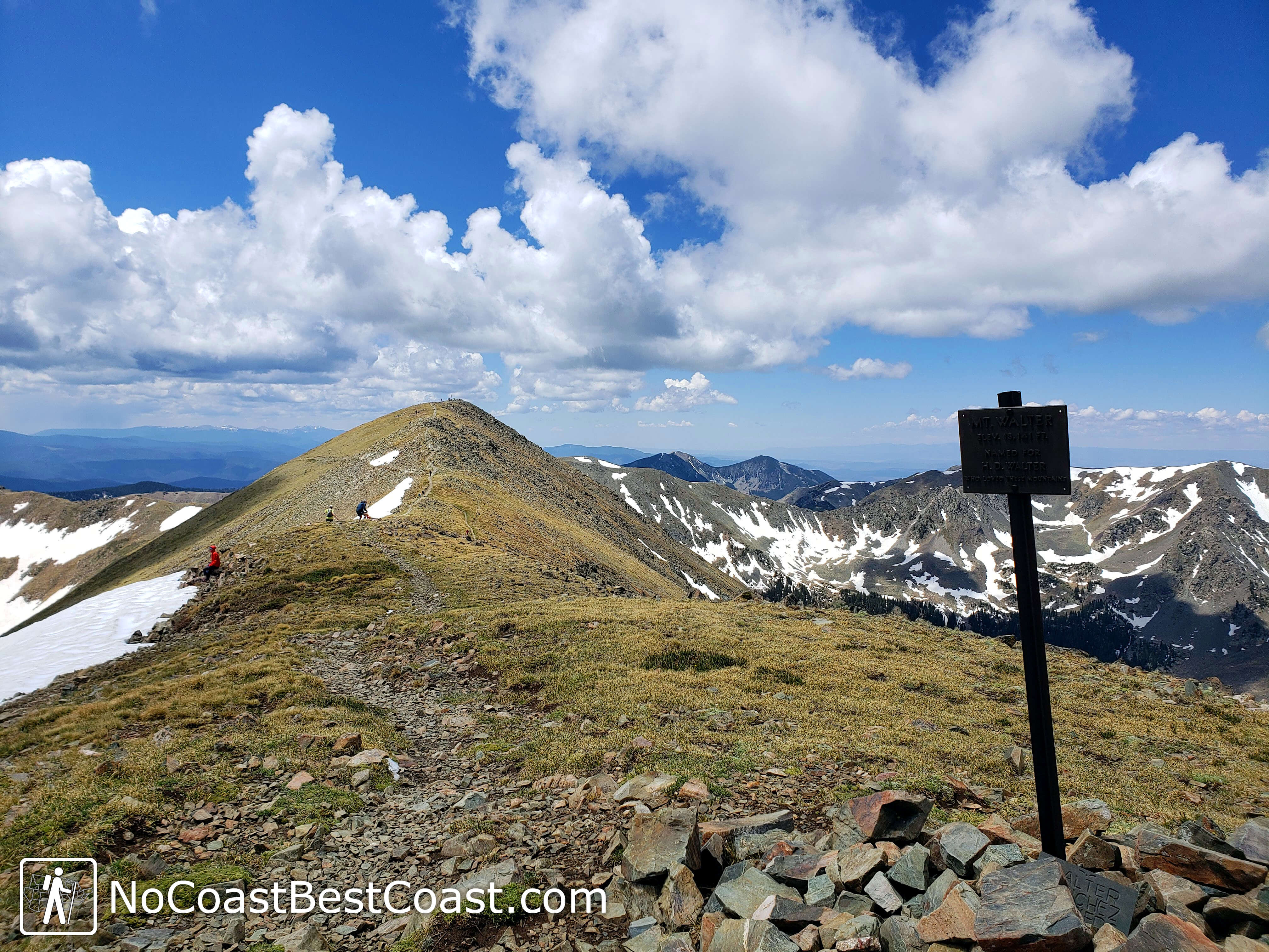
The summit of Mount Walter just before reaching Wheeler Peak
Though you should have enjoyed solitude for most of the way up, you'll see the many people who climbed up the Williams Lake Trail as you approach the final summit. Once at the top, you can say you've climbed the highest peak in New Mexico! Your reward will be a panoramic view of the Sangre de Cristo Mountains and the desert beyond. Sit and enjoy the scenery for a while until the frequent high winds and chilly mountaintop temperatures encourage you to get moving again.
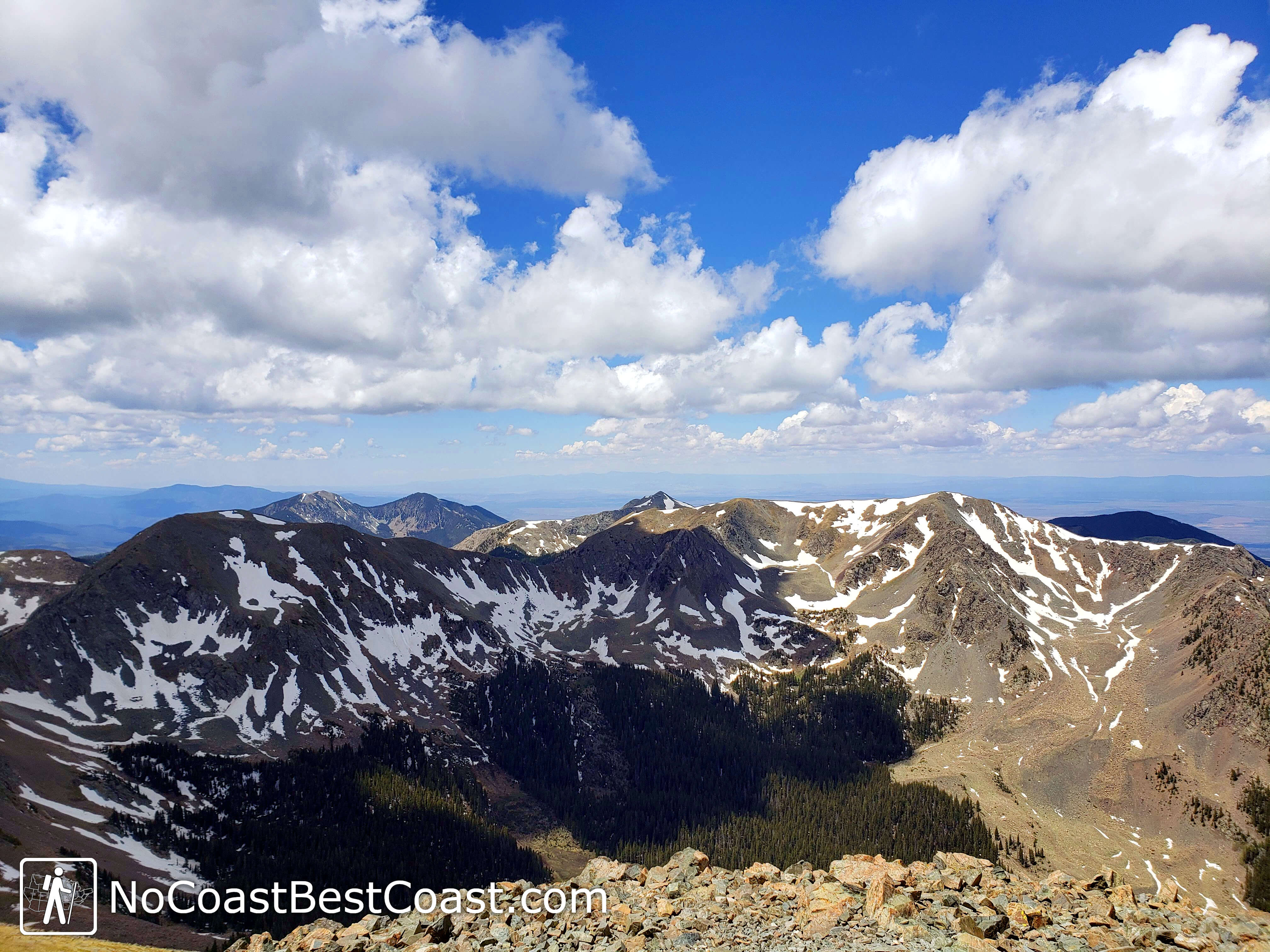
Views to the west from the summit of Wheeler Peak
The way back down is very straightforward. Follow the crowds that make a left turn from the ridge, and you can see the switchbacking route stretch far down to the treeline. If you're really lucky, there will be some snow slopes that you can enjoy sliding down on your butt -- a glissade as mountaineers call it. The view is still quite pretty, as pictured below, despite the many people on the trail.
Mountains rising above the trees on the Williams Lake Trail
After a dizzying amount of switchbacks and a knee-straining elevation loss of 2000 feet, you'll have the option to head left for a short detour to Williams Lake. Though this lake is an even more popular destination than the summit of Wheeler Peak, if you walk around the lake you can find a peaceful spot to enjoy the gorgeous alpine scenery like pictured below. Pause here for a moment before returning into the forest for the final downhill push to the parking lot.
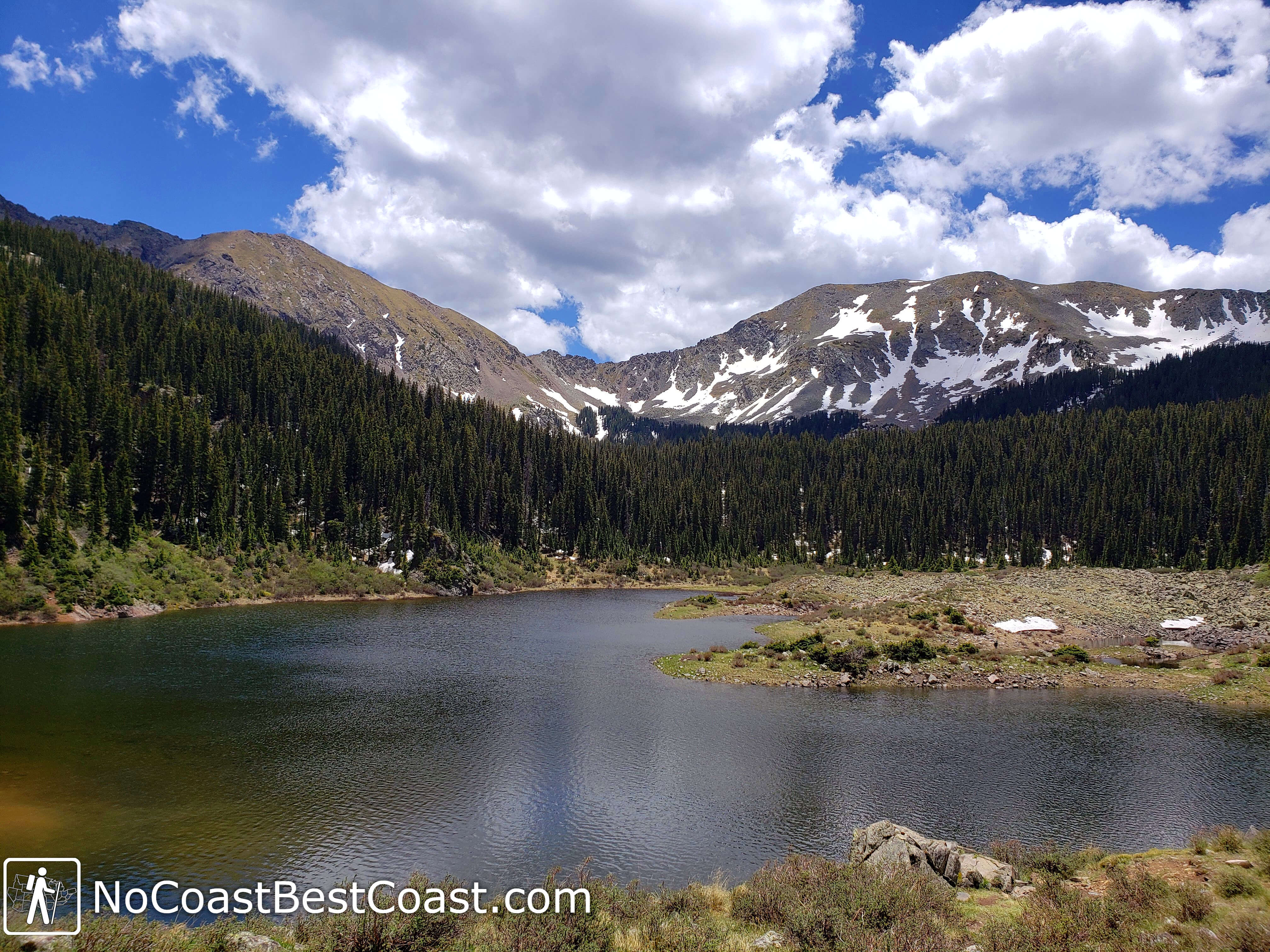
Snowy peaks and forest create a beautiful backdrop for Williams Lake
The entire trip is long and tiring, but it is absolutely worth the extra steps to take the Bull-of-the-Woods Trail where you can leave the crowds behind and see some stunning New Mexico backcountry wilderness. Enjoy the hike! Connect with me using the social media links below and share your adventures!
Important Information
Dogs are allowed on leash. This hike's difficulty is no joke; only attempt if you are adequately prepared physically and mentally. Climbing is easiest in the snow-free months, about early summer through early fall depending on the year. Afternoon thunderstorms are frequent, particularly during the summer, so start early to ensure you are below treeline before noon! Even in the summer, temperatures will be chilly as you gain elevation, so bring extra layers. Expect to see crowds of people on the Williams Lake Trail on weekends but very few on the Bull-of-the-Woods Trail.
Directions
From Taos, head north on U.S. Highway 64, then turn right on New Mexico Highway 150 towards Taos Ski Valley. Continue until you reach the ski area. Park in the Coyote lot for the closest access to the Bull-of-the-Woods Trailhead or continue on the road to park near the Williams Lake Trailhead (it's much nicer to end at the latter).
Google Maps Directions
Parking, Fees, and Facilities
Parking is free! There are pit toilets at either trailhead.
Nearby Hikes
External Links