| Rating | ★★★☆☆(3/5) |
| Overall Difficulty | Easy |
| Navigation Difficulty | Easy |
| Distance | 0.9 miles roundtrip |
| Time | 30 hours |
| Terrain | A few hills |
| Best Seasons | All |
| Family Friendly | Yes |
| Dog Friendly | Yes |
| Accessible | Yes |
Highlights
- Gigantic boulders
- Historic graffiti
- Quarry site and ruins
Hike Summary
While not a destination in itself, Elephant Rocks State Park is an excellent stop on a trip to other nearby parks like Johnson's Shut-Ins State Park. The Braille Trail truly has something for everyone: interesting geology, fun places for kids to explore, and history about the quarry. This is also the first trail I've ever seen specifically designed for the visually impaired -- green squares of carpet indicate places where an interpretive sign with braille is nearby. Wherever you may be heading after, this is certainly a worthy hike.
From the parking lot, follow the paved path towards the loop trail, then turn right when you reach the start of the loop (it was designed for you to travel counter-clockwise). The first part of the trail isn't anything special, but the interpretive signs along the side will teach you a little about the area, its geologic significance, and its quarrying past. To your left, in the center of the loop, you'll see a large mass of granite, the origin of all of the boulders in the park. Once you reach the "back" side of this granitic mass, a paved side trail will take you to the engine house ruins pictured below.

The ruins of the engine house, a remnant of the historic quarry

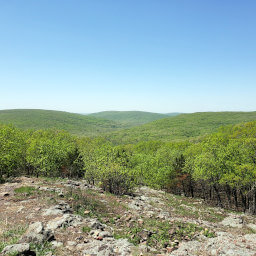
A view of the surrounding forested hills from an overlook

Historic graffiti from 1893 carved by a quarry worker

The park is named for these giant boulders that look like elephants standing in a line

The elephant rocks and the green forest beyond

The narrow passage called Fat Man's Squeeze

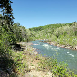
Part of the old quarry is now flooded
From the quarry's history to the oddity of the stacks of boulders, the Braille Trail is surely an interesting hike. Don't miss it on your next trip to southeastern Missouri! Connect with me using the social media links below and share your adventures!
Important Information
Dogs are allowed on leash. This entire loop is wheelchair accessible, and the interpretive signs were strategically placed along the trail for easy discovery by blind people and have braille below the text. This is an excellent trail for kids thanks to the easiness of the hike, freedom to explore near the giant boulders, and a playground to enjoy before or after the hike. You can hike here in any season. Given its proximity to Johnson's Shut-Ins State Park, this park sees many visitors.
Directions
From St. Louis, take Interstate 55 south. Take the exit for U.S. Highway 67 south toward Bonne Terre/Farmington. In Leadington, take the exit for Missouri Highway 32 and turn right. Turn left on Cedar Street (Highway N) in Bismarck and take a slight right ahead to stay on Highway N. Turn right onto Missouri Highway 21, then soon ahead, turn right into the park.
Google Maps Directions
Parking, Fees, and Facilities
Parking is free! There are both flush toilets and vault toilets (depending on the season) as well as a playground and picnic area near the parking lot. At the time of writing, the water in the park was undrinkable, but vending machines were available to purchase bottled water.
Nearby Hikes
Taum Sauk Mountain State Park, Missouri
★★★★☆(4/5)
Johnson's Shut-Ins State Park, Missouri
★★★★★(5/5)