| Rating | ★★★★★(5/5) |
| Overall Difficulty | Moderate |
| Navigation Difficulty | Medium |
| Distance | 2 miles roundtrip |
| Time | 1 hour |
| Terrain | Hilly |
| Best Seasons | Spring, Summer, Fall |
| Family Friendly | No |
| Dog Friendly | Yes |
| Accessible | No |
Highlights
- Views from on top of the Bluff Trail
- Picturesque Cascade Falls
- Peace, quiet, and solitude in a remote area of the Ottawa National Forest
Hike Summary
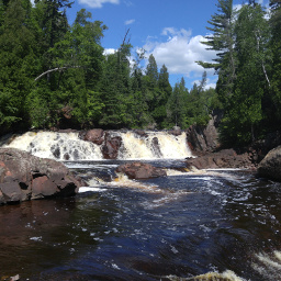
Cascade Falls is in a peaceful part of the Ottawa National Forest, and its seclusion and smaller stature when compared to other more easily viewed waterfalls like Agate Falls or Bond Falls means you won't have to share this sight with many people (or even anyone at all). This loop hike is short but packs a punch with scenery with long forested vistas from the top of the Bluff Trail.
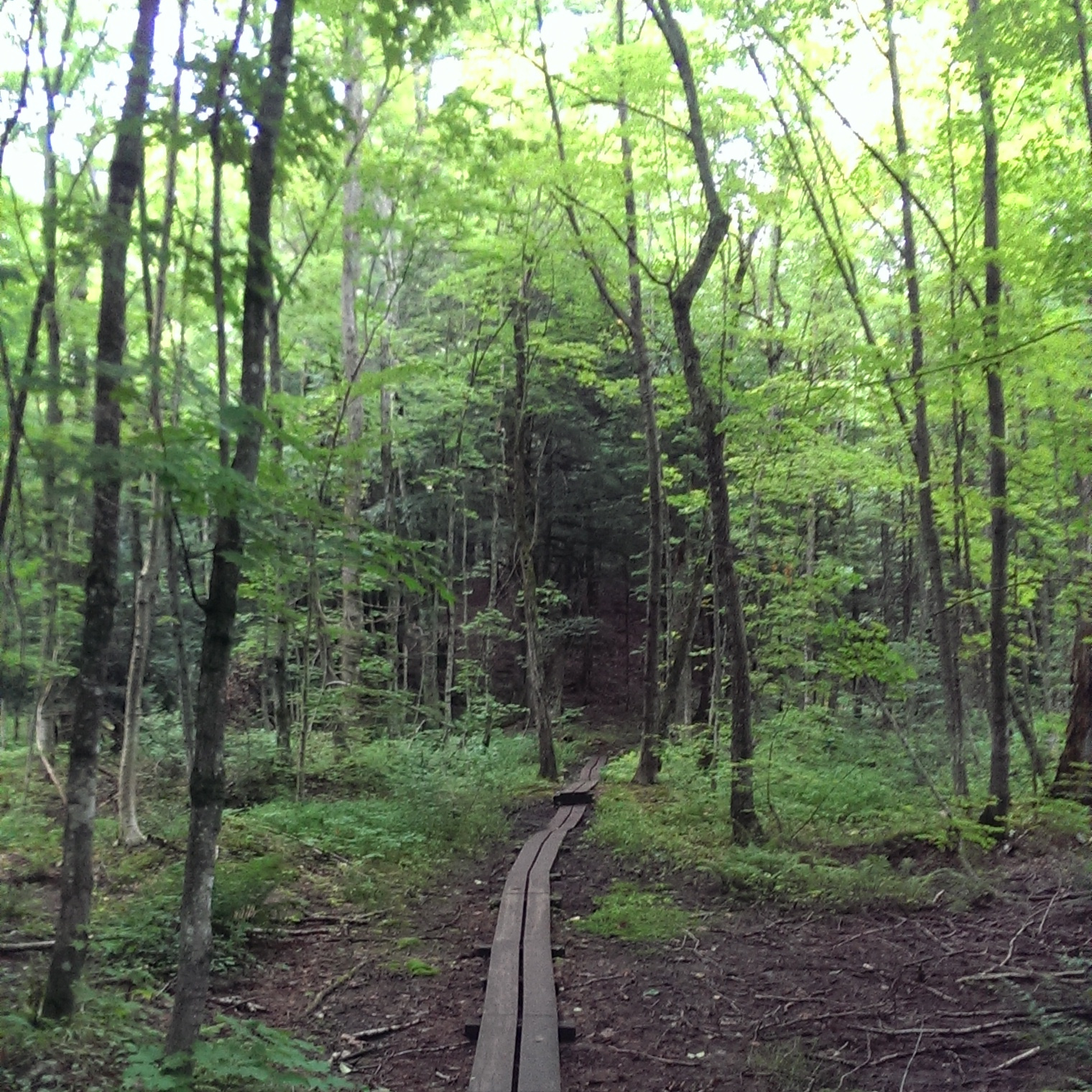
The parking area doesn't look like much, and I was unsure I was in the right place until I saw the boot brushes and signs a few steps down the trail, pictured below. At those signs, you can choose to go left up the Bluff Trail or right to the Valley Trail. I highly recommend doing the Bluff Trail first since you won't feel like going uphill after you've hiked to the waterfall. If you're hiking with kids, do the Valley Trail both ways for an easier, flatter experience.

The boot brushes and trail signs let you know you're going the right way

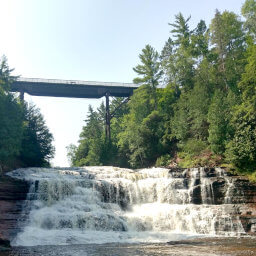
The view from the bluff looking south

The view from the bluff looking west

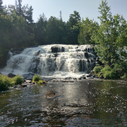
Cascade Falls is the final destination of this scenic hike
Important Information
Generally National Forests are less restricting about pets, so you can most likely have your dog off leash on this trail; whether or not that is a good idea depends on how your dog reacts to wildlife or if they're prone to wandering off into places you don't want to follow. The Bluff Trail is definitely not a family friendly trail, but if you stick to the Valley Trail both directions I think this hike would be tame enough for kids. While hiking may be possible in all four seasons, I assume the forest roads are not plowed in winter and would be impassible in the heavy Upper Peninsula snow, though you could potentially ski the 7 miles to the trailhead to see the waterfall frozen. I hiked here on a late Saturday afternoon on a gorgeous weekend and didn't see anyone else the entire time, though I passed one car as they were leaving the trailhead. You might see other hikers if you arrive closer to the middle of the day, but this waterfall is definitely off the beaten path.
Directions
The trailhead is located on a forest road approximately 7 miles from Michigan Highway 28 near Bergland. From the Ottawa National Forest Visitor Center in Watersmeet, take U.S. Highway 45 north to Bruce Crossing. Turn left on Michigan Highway 28. After about 19 miles, turn right on Forest Road 400 -- the only marker for this gravel road is a small brown trapezoidal Forest Service sign with "400" on it and an arrow pointing right, and it's pretty easy to miss. Unfortunately there aren't any major landmarks nearby to let you know the turn is coming up, but if you reach Bergland you've gone too far. Once on the gravel road, continue for about 7 miles until you see a brown sign marking the turn for the trailhead (much easier to spot than the turn for Forest Road 400). Turn right and park where the road ends.
Google Maps Directions
Parking, Fees, and Facilities
Parking is free! There are no facilities near the lot.
Nearby Hikes
Porcupine Mountains Wilderness State Park, Michigan
★★★★☆(4/5)
Ottawa National Forest, Michigan
★★★★★(5/5)
Ottawa National Forest, Michigan
★★★★★(5/5)
Porcupine Mountains Wilderness State Park, Michigan
★★★★★(5/5)