| Rating | ★★★★★(5/5) |
| Overall Difficulty | Hard |
| Navigation Difficulty | Easy |
| Distance | 9 miles roundtrip |
| Time | 5 hours |
| Terrain | Strenuous climbing, 2200 feet of elevation gain |
| Best Seasons | Spring, Fall, Winter |
| Family Friendly | No |
| Dog Friendly | Yes |
| Accessible | No |
Highlights
- Unbeatable views of the Pacific Ocean and Channel Islands
- Solitude on a less-visited peak
- Side trail to Rose Valley Falls
Hike Summary
Climbing Chief Peak was one of the most glowing experiences I've ever had while hiking. This remote peak is an Ojai landmark and the namesake of numerous Ojai and Ventura County locations, businesses, and products (including the Chief Peak IPA I enjoyed at Topatopa Brewing in Ventura on the way home from this hike). From its nearly 5600-foot elevation summit, you'll enjoy views of not only the Ojai Valley, but all of western Ventura County and the Pacific Ocean extending to the Channel Islands on a clear day. If your inability to wake up on a Saturday morning gives you a late start (like me), don't fret because there is nothing more serene than walking along the ridge road (which feels like the top of Ventura County) while watching the sunset over the ocean.
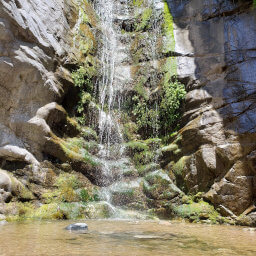
Before starting the climb, I highly recommend heading to Rose Valley Falls -- your tired legs won't want to hike the extra mile after you've summitted! Follow the trail on the south side of the campground, and you'll end at the trickling mossy cliff pictured below. After winter rains, this waterfall is much more impressive. In any case, Rose Valley Falls is one of those rare Southern California water sources and a worthy destination for any hiker.
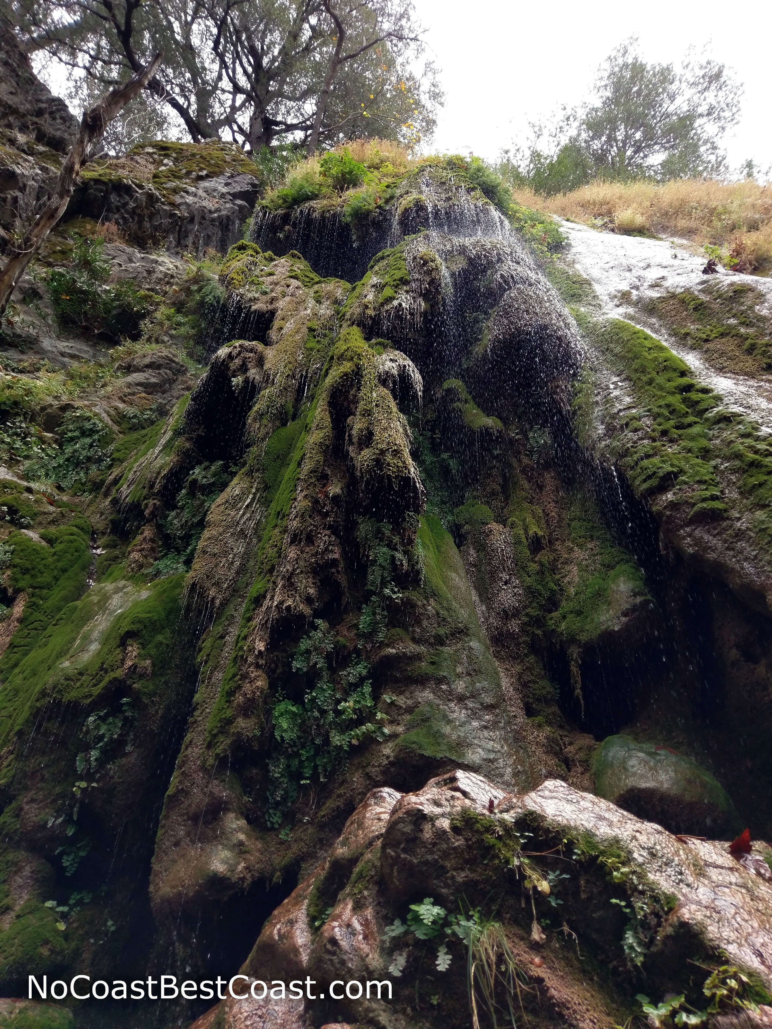
Rose Valley Falls is just a trickle in the dry autumn
The view towards the campground from the falls
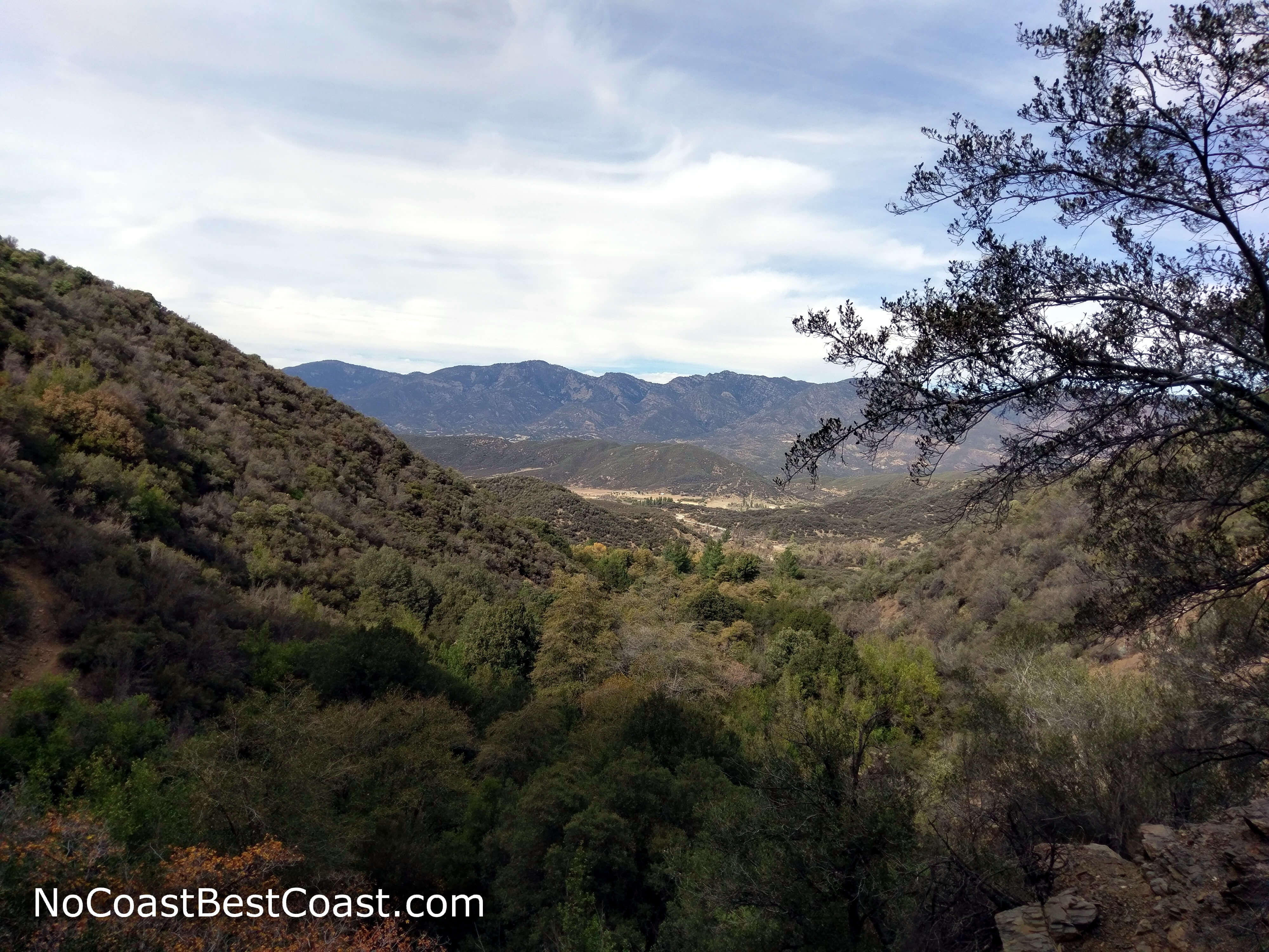
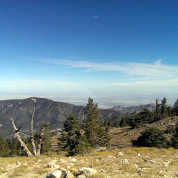
The beautiful green topography of the Los Padres National Forest
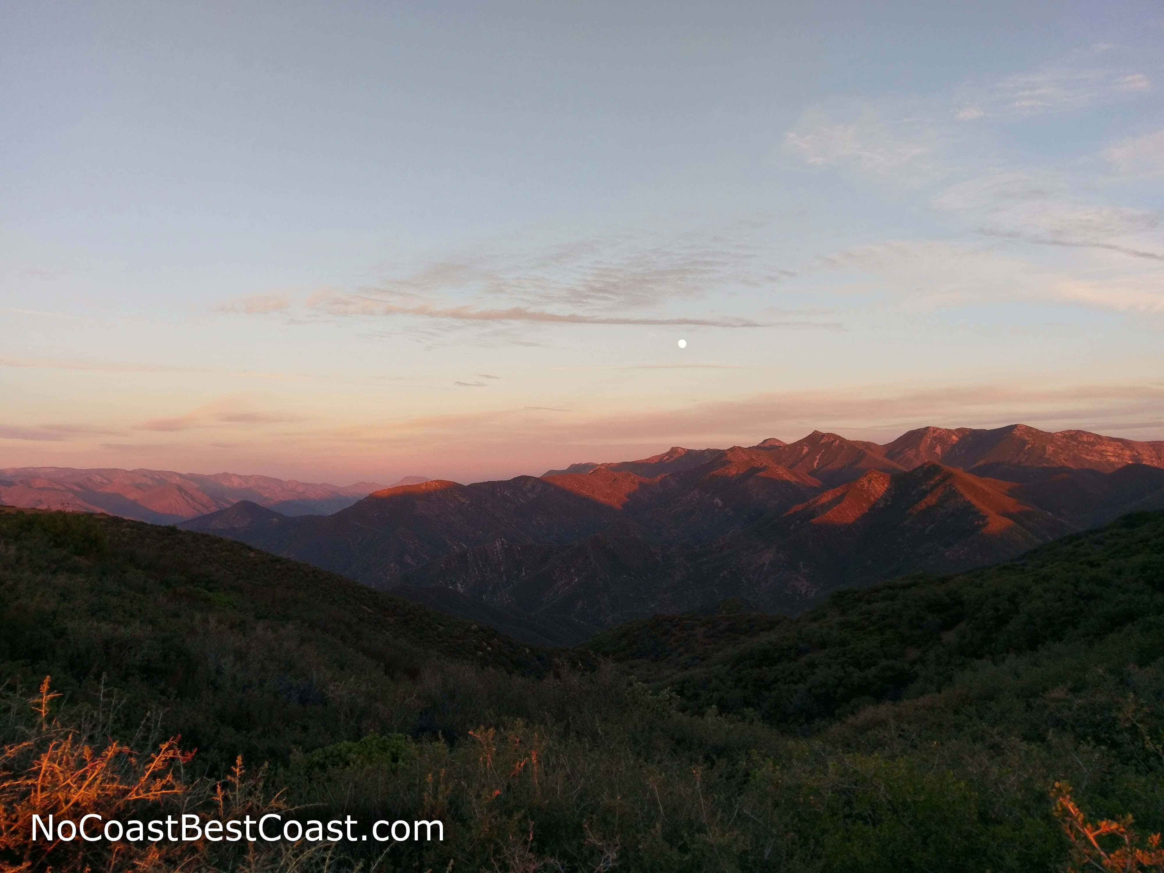
A full moon rising above the Topatopa Mountains
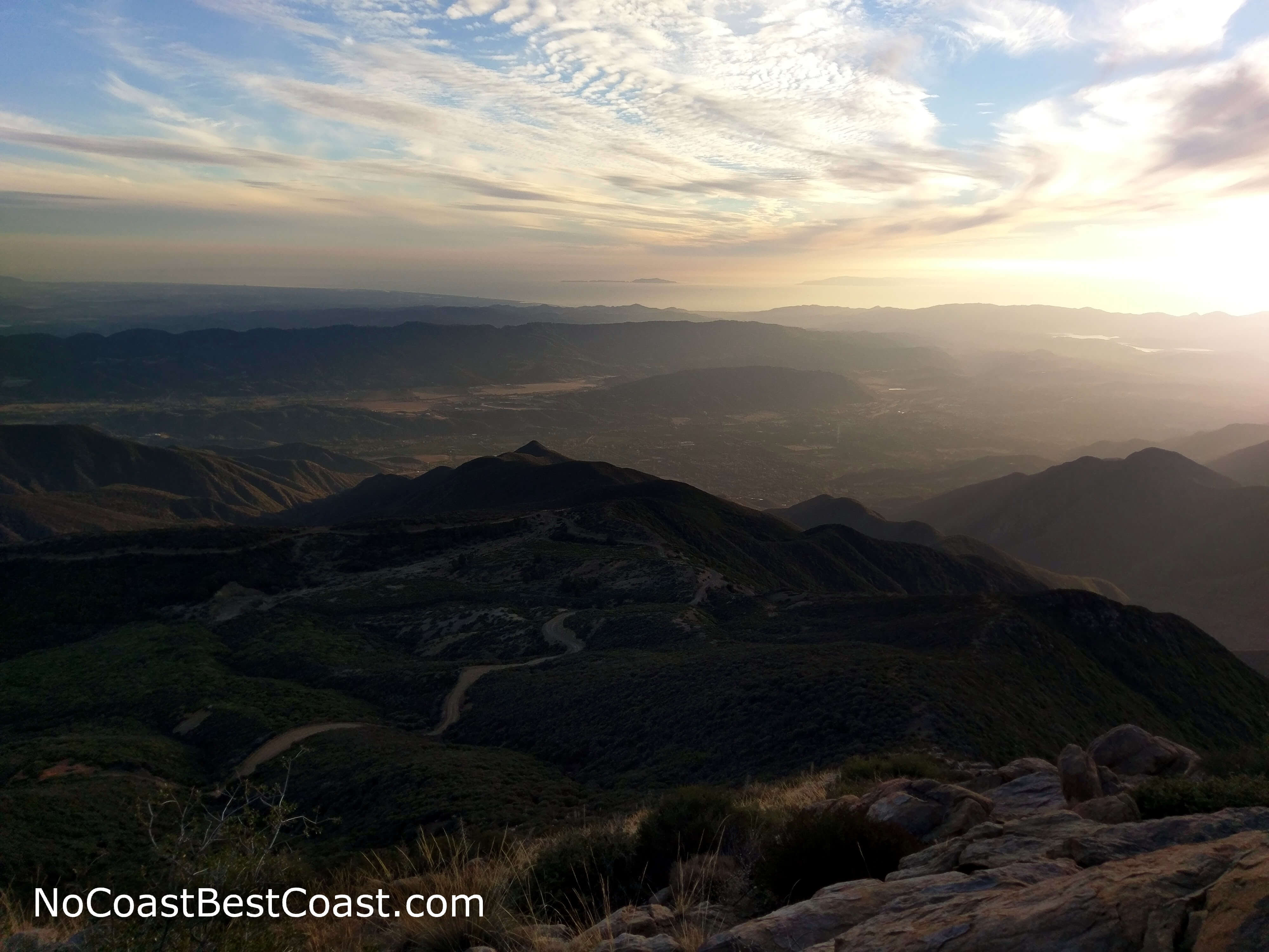
Sunset along the Nordhoff Ridge Road
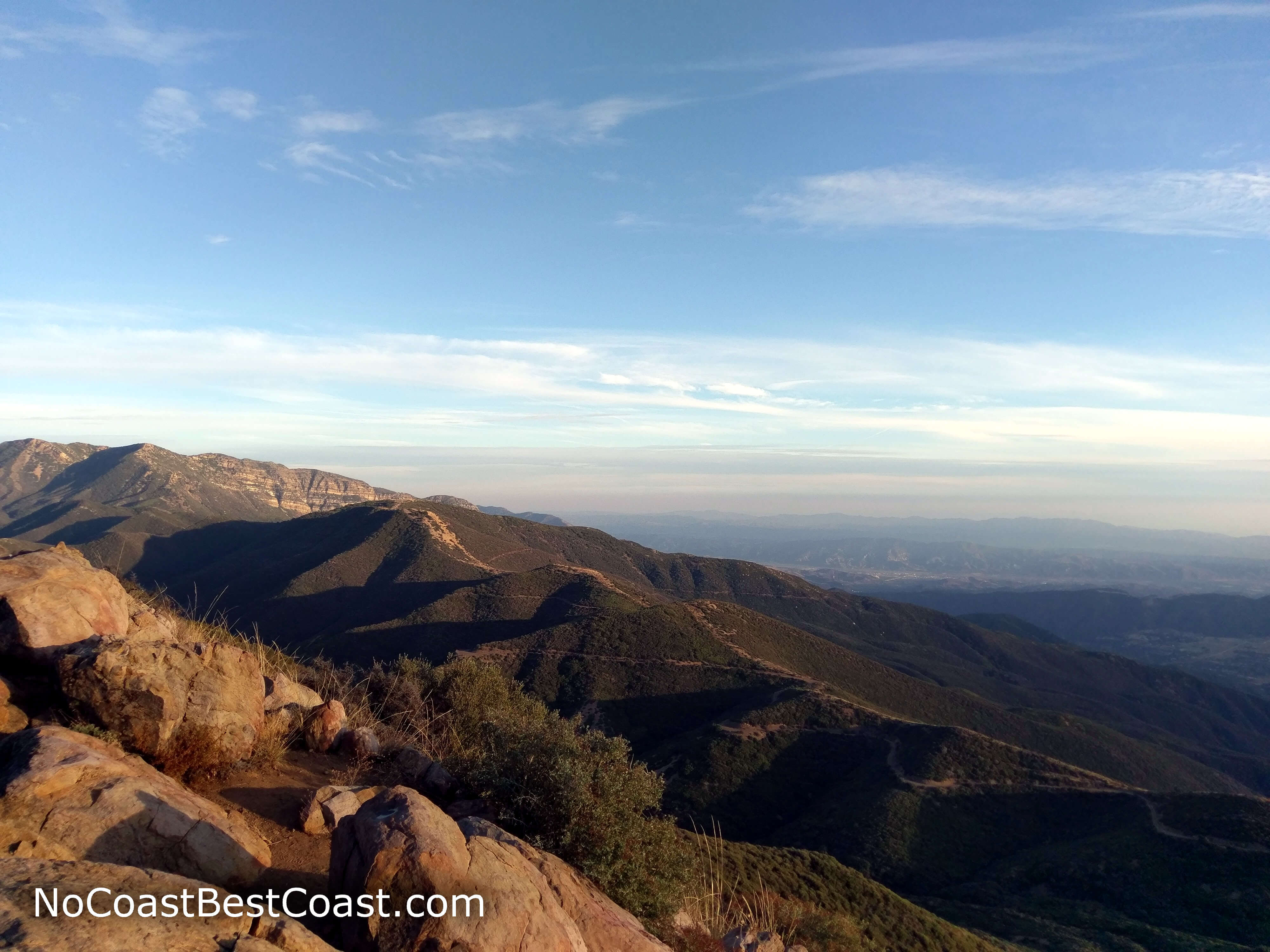
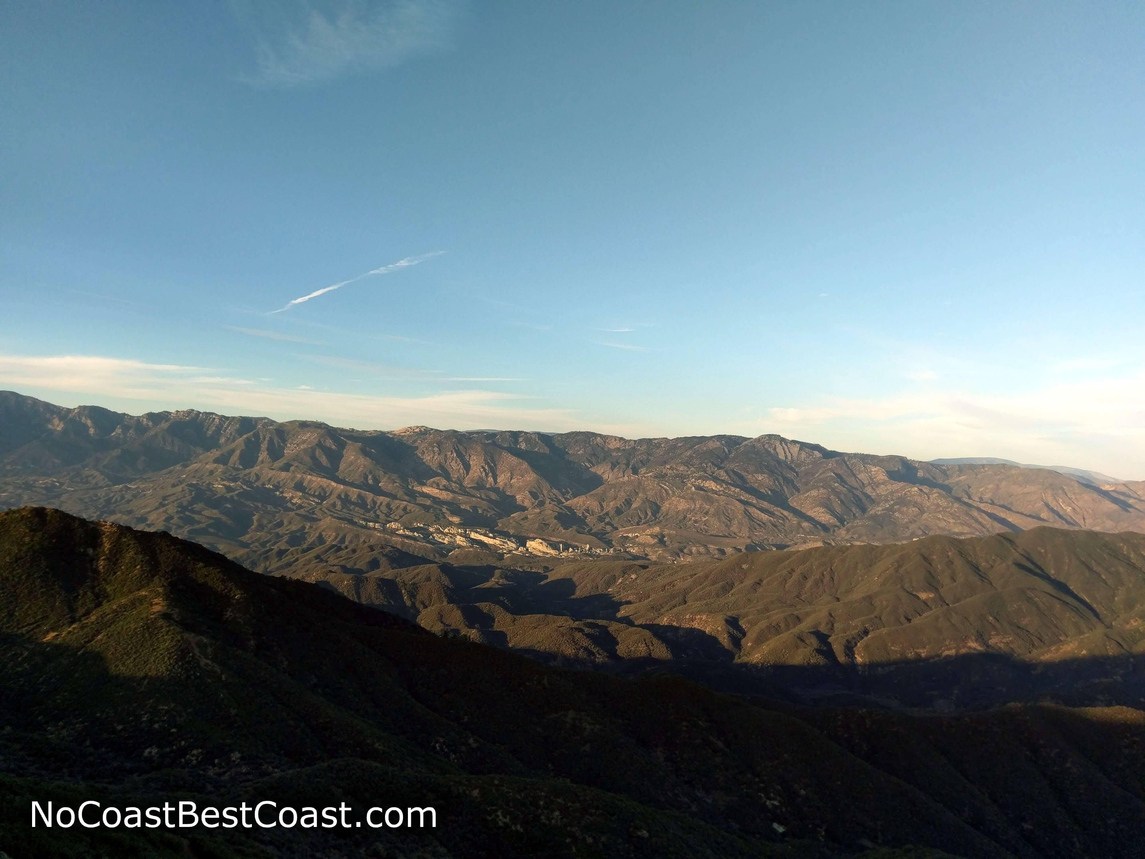
A view of the Nordhoff Ridge Road as it continues towards the iconic ridge of Topatopa Bluff
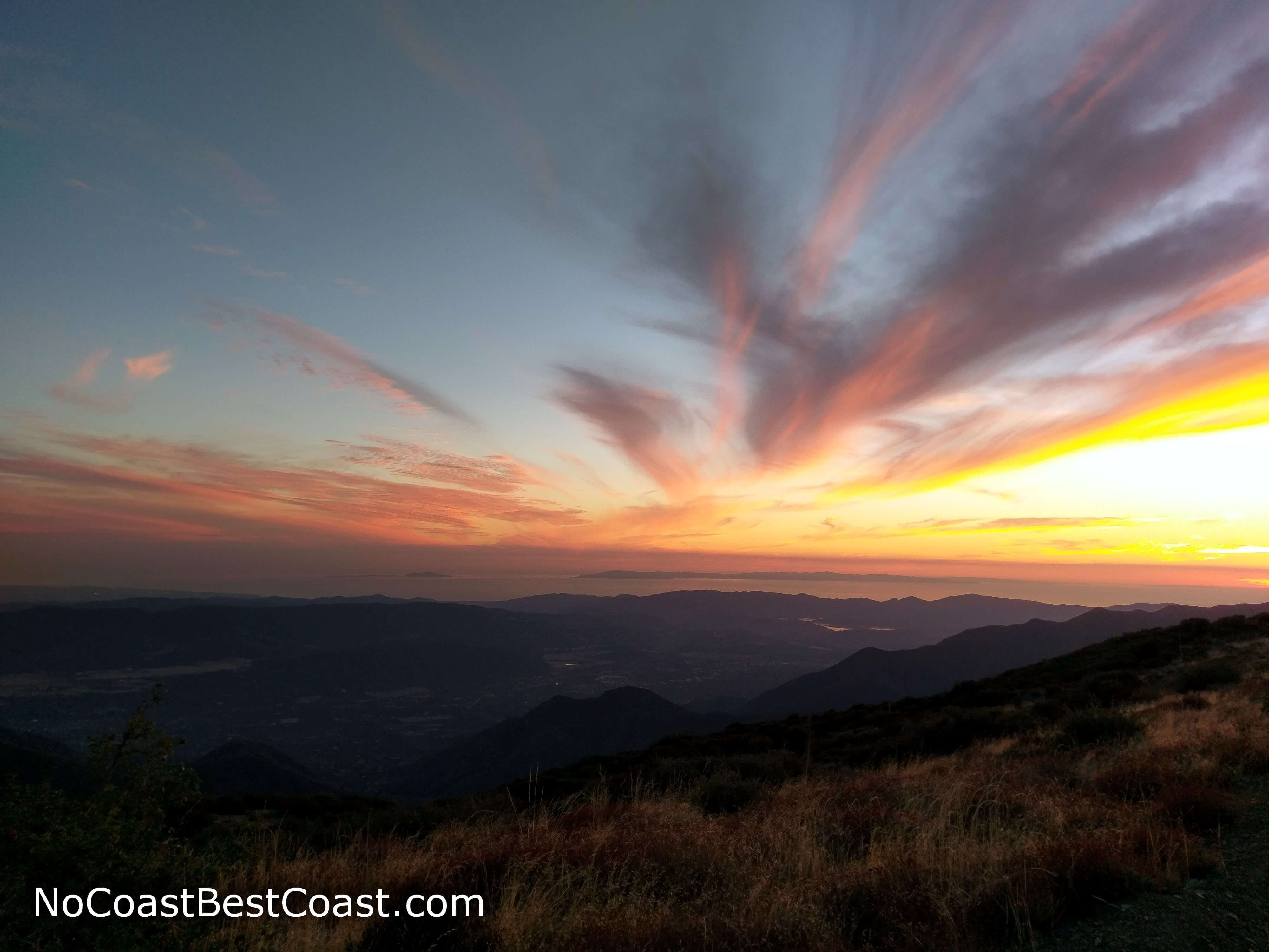
Golden sunlight over the Ojai Valley and Pacific Ocean as seen from Chief Peak's summit
Important Information
Rules about dogs are generally pretty relaxed in national forests once you leave the popular trails and recreation areas, but I couldn't find any specific information about Rose Valley. Dogs are definitely allowed on leash, and you could easily get away with going off leash once out of sight of the campground. This route certainly is not family-friendly, but the short hike to Rose Valley Falls from the campground is. Spring, fall, and winter are the best seasons to hike since summer in this mostly shadeless environment can be terribly hot unless you start before sunrise. While snow may fall at this elevation, it usually doesn't remain for long. Sun protection is a must, and you should bring plenty of water in any season. This trail is far from LA and the population centers of Ventura County, so you won't see many people on this hike, though the campground may be full on a nice weekend.
Directions
From Los Angeles, take U.S. Highway 101 to Ventura, then head north on California Highway 33 towards Ojai. Turn left to stay on California Highway 33 towards Maricopa. Turn right on Rose Valley Road in about 15 miles, then turn right again in 3 miles at the brown sign pointing towards the campground.
Google Maps Directions
Parking, Fees, and Facilities
If you aren't camping here, you must park at the day-use area north of the campground or alongside the road outside of the campground. No fee or Adventure Pass is required to park in the day-use area. There are pit toilets available near the day-use parking and in the campground.
Nearby Hikes
Los Padres National Forest, California
★★★★★(5/5)
Los Padres National Forest, California
★★★★☆(4/5)
Angeles National Forest, California
★★★★☆(4/5)
Red Rock Canyon State Park, California
★★★★☆(4/5)