| Rating | ★★★★★(5/5) |
| Overall Difficulty | Hard |
| Navigation Difficulty | Medium |
| Distance | 12 miles roundtrip |
| Time | 6 hours |
| Terrain | Hilly |
| Best Seasons | Spring, Fall |
| Family Friendly | No |
| Dog Friendly | No |
| Accessible | No |
Highlights
- Serene trek through wilderness with many scenic views
- Excellent wildlife viewing opportunities
- Petrified forest and prairie dog towns
Hike Summary
This was probably one of my best hikes of 2018, and definitely one of the most memorable parts of a weeklong excursion throughout the Dakotas. You'll trek through a large portion of one of the wilderness areas of the park and experience things most visitors here will never see, like the petrified forest. Wildlife viewing is unparalleled, and during this hike I saw bison, wild horses, pronghorn, prairie dogs, and even a rarely seen caribou. If you have the time and stamina for a 12 mile hike, I cannot recommend this trip enough.
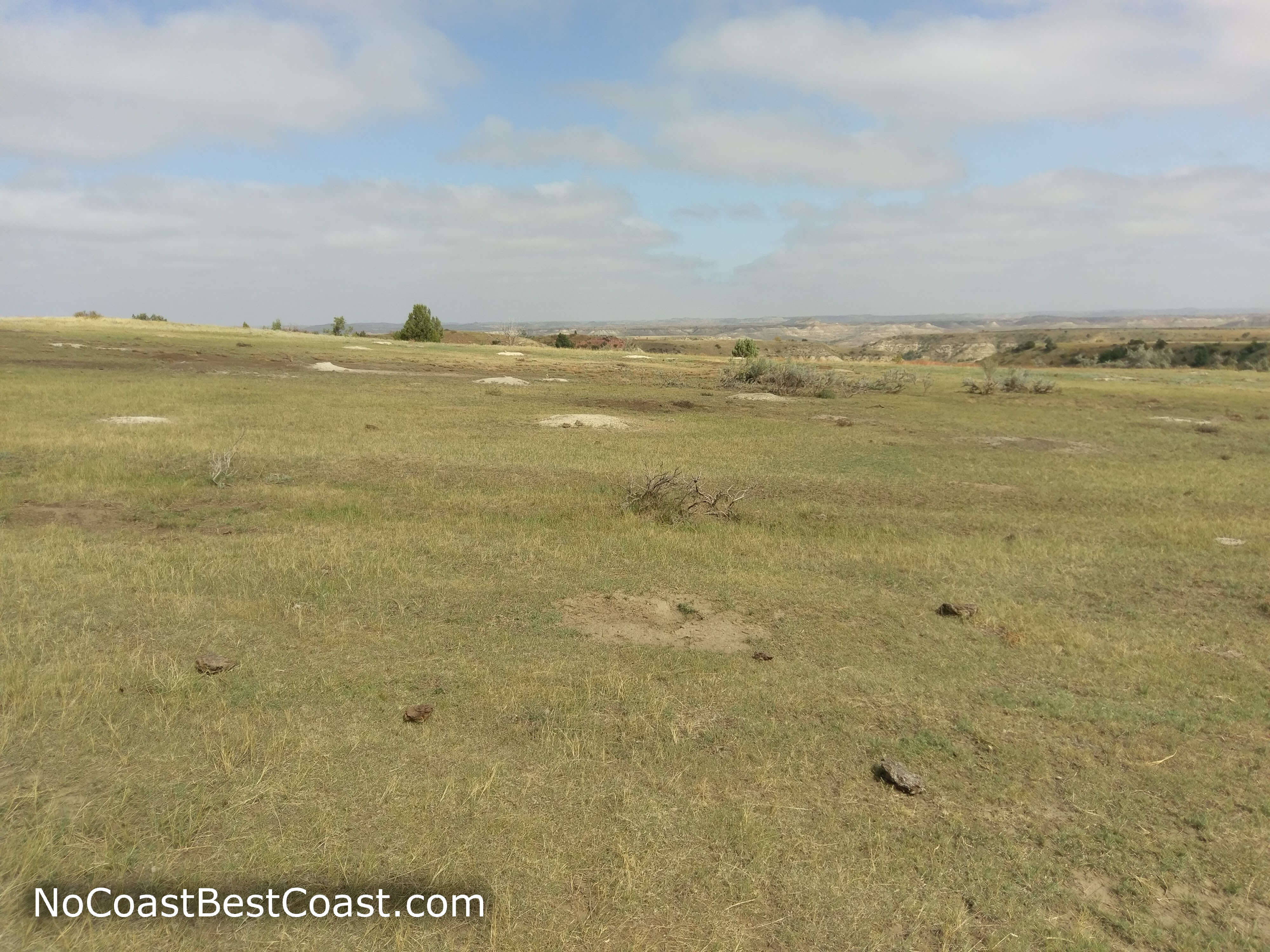
The adventure starts almost immediately, with a mandatory bridge-less river crossing less than a quarter mile from the trailhead. The ease of this crossing depends heavily on the time of year and recent rainfall events. I was lucky enough that the river wasn't much more than ankle deep the entire way across, although it was quite chilly and inconveniently required I remove my shoes and socks. Other times of the year, however, this crossing may be too dangerous to attempt. If you feel uncomfortable with this river crossing, just turn around -- you haven't invested much energy at all to get here, and you can do this exact loop or something similar by driving the unpaved road to the trailhead for the petrified forest area (though you'll add at least 2 miles roundtrip to your hike in this case). Once on the other side, you'll have a view similar to that pictured below.
Shortly after the fork, you will pass through a prairie dog town. I don't think it's possible to watch prairie dogs and be unhappy, with their cute chubby bodies scurrying about and into their holes while barking with a sound like a chihuahua that swallowed a squeaky toy. Hopefully you don't mind walking through the prairie dog town, since there will be two more later in the hike, the second of which is utterly massive. After the prairie dog town, you'll cross a seasonal creek, which could look like a full-fledged stream or the muddy mess pictured below depending on the season and rainfall. The Ekblom Trail meets with the Maah Daah Hey Trail ahead, and you'll stay right to continue on the loop. After nearly half a mile, you'll turn left onto the Lone Tree Loop Trail, a long, scenic route through the heart of badlands wilderness. Near the start of this trail, you'll cross the second of three prairie dog towns. Tall cliffs will surround you on either side, and if you're lucky you'll see some of the large mammals that call this place home, like bison or the wild horses pictured below. Be cautious around any of these animals and keep your distance -- these are wild animals and they are unpredictable and irrational. Similar to my experience with cows in the Sheyenne National Grassland, the two wild horses stopped and stared at me in a way that made me uncomfortable. They might only eat plants, but they are still much larger and faster than you and me. All along the first third of the Lone Tree Loop Trail, the seasonal Knutson Creek will cross your path. Some crossings have little bridges like pictured below, but others require you to jump or wade depending on how wide and deep the water is. In addition, you may also find multiple sets of trail markers around creek crossings and you must use your best judgment to discern which are the most recent. Sometimes the age of markers is obvious, like when one set is cracked and weathered and falling over while another is pristine, but other times you'll have to choose between newish flat brown stakes and decent looking wooden posts (both types of markers are shown in the picture below). Both routes will eventually get you to the same place, but in my experience the newer markers often showed the better route, especially when finding a spot to cross a creek. Not far from the second prairie dog town, you'll reach Tomamichael Well, a place where a man-made concrete basin captures waters from a below-ground spring. None of the naturally occurring water in the park is drinkable as-is and must be purified and filtered before consumption. As famously stated by Theodore Roosevelt, "Water is a commodity not by any means to be found everywhere... When found, it is more than likely to be bad, being either from a bitter alkaline pool, or from a hole in a creek, so muddy that it can only be called liquid by courtesy." Sure, the water from this well can technically become drinkable, but it will likely be unpleasant. Eventually, you'll reach a point where another creek converges with Knutson Creek, which was my most difficult water crossing, pictured below. This was another case where there were multiple routes designated by markers, but I quickly found out which one was the "old" route since there was no easy crossing in that direction. The water here was the deepest yet (even deeper than the Little Missouri River, surprisingly), and there were no rocks poking out of the disgusting muddy water. I had no choice but to leap; I just barely missed the edge, and my left leg slid into knee deep sludge. Uninjured but shocked and dirty, I hiked on. After that difficult stream crossing, the trail starts a steady climb uphill alongside the creek (but never crossing it!). In the distance on the left side of the trail, you may be able to see the fence denoting the western border of the park. The trail turns to the right, and you'll see the starting point of the creek from above the gouge in the earth where it travels. Now the trail enters a narrow gorge with a few more trees as you continue climbing uphill and out of the badlands canyon.
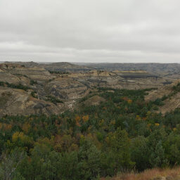
When you reach the top, you'll be amazed by the seemingly alien flatness of the prairie so close to such a topographically interesting area. The Lone Tree Loop Trail meets the South Petrified Forest Trail, and you can turn left for a side trip to the petrified forest area or you can turn right to finish the loop. Visiting the petrified forest adds a couple miles roundtrip (already included in the total miles at the top of the page) to the 9.6 mile loop, but honestly if you can hike nearly 10 miles, adding another 2 won't make much of a difference especially since it means seeing one of the most remote, least visited attractions of the park. Hands down, this is the most boring section of the entire loop. The trail is straight and flat, and there isn't much to look at other than a few glimpses of the badlands to the south. However, if you're as lucky as me, you will see caribou, pronghorns, or other large game grazing on the prairie. Despite the uninteresting trail, the petrified forest is worth the pain, as you'll see once you begin descending back into the badlands as pictured below. The giant boulders you see are actually fossilized trees! Explore the petrified forest as much as you like, then head back the way you came to resume the loop. Unfortunately, it's another 2 miles of flat prairie before you return to anywhere interesting (suddenly I understood why people ride horses so much in the Great Plains). The South Petrified Forest Trail ends at the Maah Daah Hey Trail, and you'll turn right and the left again onto the Big Plateau Trail in less than a quarter mile. Finally, you'll have another view. Perhaps it was because the sun was starting to come out, or maybe I was just tired of the prairie, but in that moment the picture below felt like the best view ever. Finishing the hike with the Big Plateau Trail is the best decision you can make on this trip. After slogging through miles of flat, grassy nothingness, you'll emerge on the top of the badlands. It's all downhill from here, and you'll be enjoying views like pictured below for over a mile! The icing on the cake is the third gigantic prairie dog town pictured below that stretches for what seems like a mile (it may very well be a mile judging by the size of it on the official map). For me, this was one of those hiking moments that I live for: marching downhill with commanding views of neverending badlands formations while prairie dogs bark and scamper about. You will feel like you are on top of the world, especially if the sun is shining with that beautiful blue "sky is not cloudy all day" prairie sky. At the end of the plateau, you'll descend a rocky slope with some steep parts before meeting the end of the loop just before the river. While you may have dreaded the river crossing at the beginning of the hike, your aching, sweaty feet will be begging for that refreshing cool walk across the river.
This is no doubt one of the best hikes in the entire park. You will see every type of environment that exists in the park, and the unspoiled wilderness area will provide an adventurous experience with ample opportunity for seeing wildlife. What are you waiting for, plan your trip now! Let me know what you think in the comments section below, and be sure to use #nocoastbestcoast on Twitter and Instagram!
Important Information
Dogs are prohibited on all trails in Theodore Roosevelt National Park. None of the trails leaving from here are family friendly since they require fording the river and the shortest route is over a 5 mile loop; stick to the well-known trails along the scenic loop drive if you're traveling with children. While the park is open all year, I do not recommend hiking this lengthy, shadeless trail during the summer or during the freezing winter -- in addition to the cold, route finding in the wilderness would be even more difficult in the snow. In any conditions, bring plenty of water, food, and extra clothing since you may not encounter another soul during this entire trek and you will be miles from anyone able to assist you.
Directions
From Interstate 94, take the exit for Medora (different depending on which direction you are coming from). Continue through the town and turn to enter Theodore Roosevelt National Park. Follow the main park road, then turn left further down the road from the campground. Take the next left towards Peaceful Valley Ranch and park at the trailhead.
Google Maps Directions
Parking, Fees, and Facilities
Entrance to the park requires paying the $30 vehicle entrance fee valid for 7 days, except on designated fee free days. Annual passes for Theodore Roosevelt National Park are also available at $55. Interagency annual passes are available for $80 with discounts for seniors, military, and those with disabilities. Visit the Theodore Roosevelt National Park webpage about fees for more detailed information. There are no facilities available near the lot.
Nearby Hikes
Theodore Roosevelt National Park, North Dakota
★★★★☆(4/5)
White Butte, North Dakota
★★★★★(5/5)
Theodore Roosevelt National Park, North Dakota
★★★★☆(4/5)
Theodore Roosevelt National Park, North Dakota
★★★★★(5/5)


