| Rating | ★★★☆☆(3/5) |
| Overall Difficulty | Moderate |
| Navigation Difficulty | Easy |
| Distance | 5 miles roundtrip |
| Time | 2.5 hours |
| Terrain | Hilly |
| Best Seasons | All |
| Family Friendly | No |
| Dog Friendly | Yes |
| Accessible | No |
Highlights
- Longer hike into pine forest
- See nests of birds of prey
Hike Summary
Escape the crowded beach and hit the trails located a little further down the park road. While there isn't anything noteworthy to see on this hike, the solitude, peace, and high quality nature make this hike much more enjoyable than anything similar closer to a city. Even the official park map (linked at the bottom of the page) mentions this trail is a good place to escape people, so whatever I've said must be true.
Dogs are allowed on leash. This hike is too long and hilly to be family friendly; as an alternative, check out the Big Hole Loop or Pickerel Lake Trail. Hiking and snowshoeing are allowed anywhere in the park during the winter as long as you stay off the groomed ski portions of the trail, so you can enjoy this hike any time of the year. I visited on a gloomy Sunday fall morning and only saw a couple people. Summer is usually busier than spring or fall, but you shouldn't see many people in the more remote portions of the trail here.
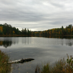
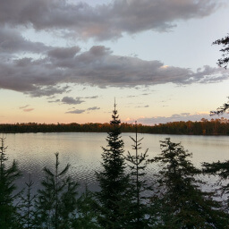
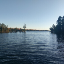
From the parking lot, cross the dirt road and head down the trail. Turn right at the first intersection and continue on the Pickerel Lake Trail -- this is the longer, more scenic route to Red Top and the lakefront views pictured below are well worth the extra miles. If you started at the alternative parking lot, follow the trail heading northwest towards the road, then turn left at the intersection after crossing the road -- the difference in mileage between this route and the main route is insignificant. At the end of the Pickerel Lake Trail you will begin climbing uphill to the Big Hole Trail.
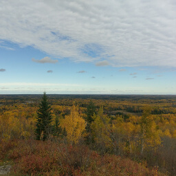
The next section will be comparatively flat as you continue straight to the Red Top Loop. Once you reach the loop, you can choose to go either direction. I'm not sure why this place is called Red Top, but my guess is it's named because it sits at the top of a ridge and has red pines or due to the red color of maples in the fall. At some point on the southern half of the loop, you will walk past the tree pictured below with a large bird's nest, most likely from some sort of bird of prey. There are a few places where you have a slight view from the top of this ridge, but nothing photogenic thanks to the dense vegetation blocking most of the views. You can either complete the Red Top Trail Loop in its entirety and retrace your steps shortly before turning left at intersection 7, or you can veer from the loop at intersection 9. Both routes eventually meet at intersection 4, but the former is a bit longer but flatter, hiking on the top of the ridge, while the latter descends to some hillier terrain. I took the former, and near the end you will see the nice grove of evergreens shown in the picture at the top of the page.
When you reach intersection 4, continue straight then turn right to return to the main lot, or turn left if you parked at the alternative lot. Though this hike isn't anything special, it's still a good longer route for some quality solitude in nature. Let me know what you think in the comments section below and be sure to use #nocoastbestcoast on Twitter and Instagram!
Directions
From Grand Rapids, MN take U.S. Highway 169 north to Chisholm, then take the exit for Minnesota Highway 73. Or from Virginia, MN take U.S. Highway 169 south to Chisholm, then turn right onto Iron World Road and right again onto Minnesota Highway 73. Take the first left onto 6th Street, then turn left again immediately onto County Highway 5. In 15 miles, watch for signs indicating McCarthy Beach State Park, and turn left onto McCarthy Beach Road. Look for the turnoff for the park office and pay the vehicle fee, then continue on McCarthy Beach road, turning right on a narrow dirt road -- Google Maps has it labeled as 915, but I vaguely remember the sign labeling it as 913 or 917. Drive very slowly here as the road is only one lane wide and can be rough (still passable in a sedan though). Luckily, the small parking area isn't far from the main road, and you'll soon see it on the left.
Google Maps Directions
Parking, Fees, and Facilities
Like all Minnesota State Parks and Recreation Areas, you must pay a vehicle entry fee of $7 per day or $35 for an annual pass (highly recommended if you frequently go to Minnesota State Parks). There are no facilities at this lot. If this lot is full (there's only room for a few cars), continue down the dirt road and turn right on Ski Trail Road, then quickly turn left into another larger parking area -- note this lot has pit toilets. You will have to modify your route slightly if you start from this alternative lot.
Nearby Hikes

McCarthy Beach State Park, Minnesota
★★★★☆(4/5)

Superior National Forest, Minnesota
★★★★★(5/5)

Scenic State Park, Minnesota
★★★★★(5/5)

Bear Head Lake State Park, Minnesota
★★★★☆(4/5)

