| Rating | ★★★☆☆(3/5) |
| Overall Difficulty | Easy |
| Navigation Difficulty | Easy |
| Distance | 1.6 miles roundtrip |
| Time | 1 hour |
| Terrain | Mostly flat |
| Best Seasons | All |
| Family Friendly | Yes |
| Dog Friendly | Yes |
| Accessible | Yes |
Highlights
- St. Croix River views
- Suited for all ages and abilities
- Swimming beach nearby
Hike Summary
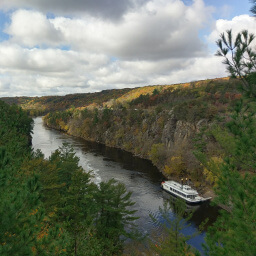
The highway divides William O'Brien State Park into two parts: the western part which is hilly with forest and prairie and the eastern part which is low and flat next to the St. Croix River. Hikes in the western part like the Hiking Club Trail are generally more difficult, so head to the eastern side to do the one and only hike there, the Riverside Trail. Here, you can enjoy looking at the hills surrounding the St. Croix River without having to climb them while circling through a shady forest with some 100 year old pine trees.
Dogs are allowed on leash. Not only is this a great family friendly hike, but the trailhead is also near the swimming beach and boat rental so you can have even more fun after the hike. This trail is designated as accessible, as confirmed by the official park map linked on the bottom of the page. This is the only trail in the park that permits hiking in the winter, since everywhere else is groomed for cross country skiing; enjoy this trail in every season! This trail circles a campground and starts at the busy day use area, so expect to see many people during your hike.
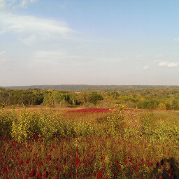
Since this is a loop, you can go either direction. Navigation is straightforward because there aren't any other trails on this portion of the park except for the trail on the side of the road linking this part to the rest of the park. When you reach the road, cross and continue straight to remain on the Riverside Trail. The scenery is mixed hardwood and pine forest, and unsurprisingly, more than half of the trail is on the side of the river. Lake Alice is also quite beautiful because of the hill on the opposite side. The two pictures below and the picture at the top of the page depict the standard view from the trail.
Directions
From the Twin Cities, take Interstate 35 north and exit at Minnesota Highway 97. Turn right, and follow the signs for Minnesota Highway 97 at the two traffic circles ahead. Stay on Minnesota Highway 97, then turn right onto Minnesota Highway 95 (St. Croix Trail). Look for signs for the park, then turn right. Pay your fee at the park entrance, then turn left at the stop sign ahead. Continue straight, go under the highway, then park in the lot at the end of the road.
Google Maps Directions
Parking, Fees, and Facilities
Like all Minnesota State Parks and Recreation Areas, you must pay a vehicle entry fee of $7 per day or $35 for an annual pass (highly recommended if you frequently go to Minnesota State Parks). There are flush toilets (pit toilets in the winter), picnic shelters, a swimming beach, boat rental, and fishing dock near the lot.
Nearby Hikes

William O'Brien State Park, Minnesota
★★★★☆(4/5)

Interstate State Park, Wisconsin
★★★★★(5/5)

Interstate State Park, Minnesota
★★★★☆(4/5)

Interstate State Park, Minnesota
★★★★☆(4/5)


