| Rating | ★★★★★(5/5) |
| Overall Difficulty | Easy |
| Navigation Difficulty | Easy |
| Distance | 1.7 miles roundtrip |
| Time | 1.5 hours |
| Terrain | A few hills |
| Best Seasons | All |
| Dog Friendly | Yes |
| Accessible | No |
Highlights
- Spectacular waterfalls
- Quick, scenic hike perfect as a stop on a road trip
- Narrow gorge and rocky cliffs
Hike Summary
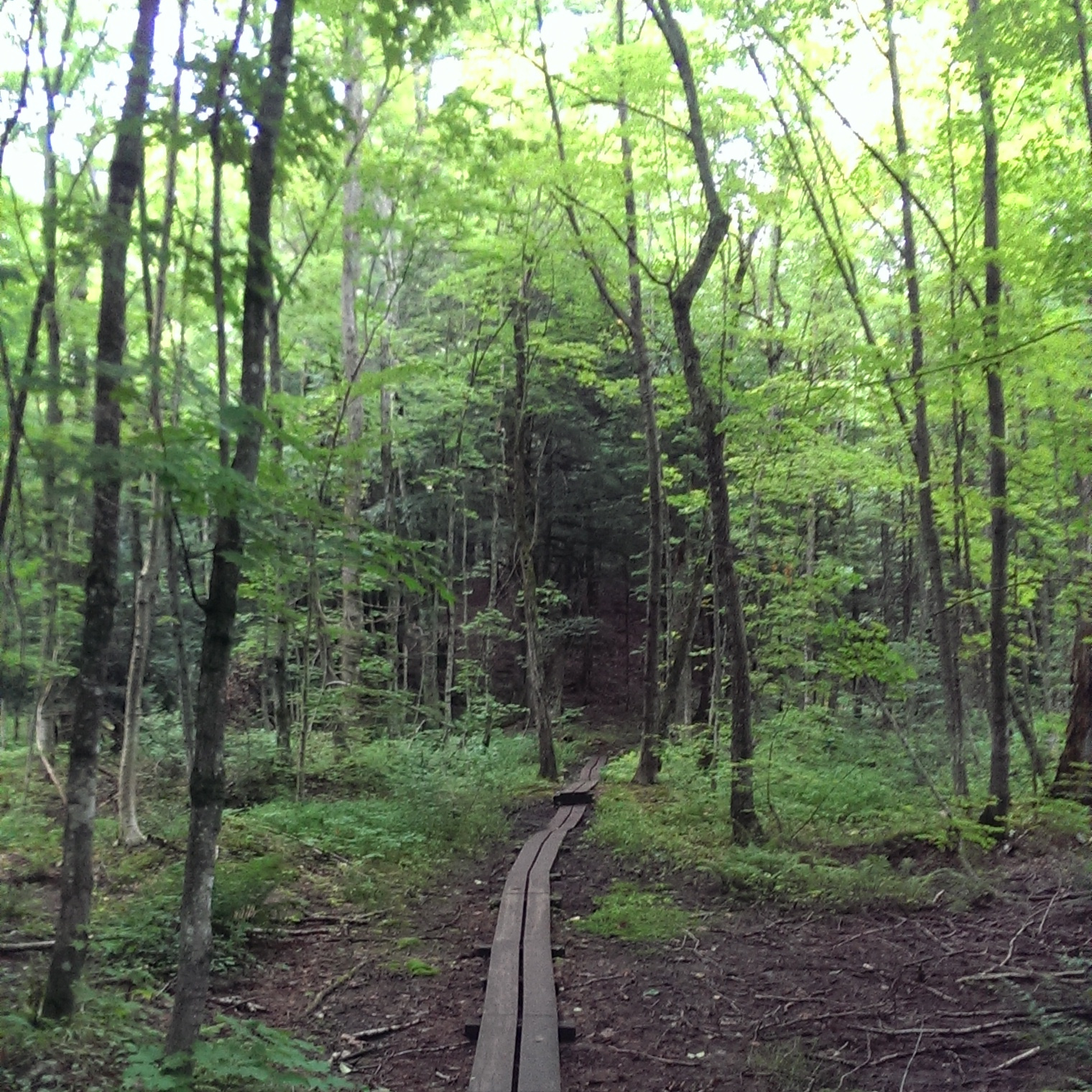
This hike was exactly the break I needed during a long drive from the Twin Cities to the Porcupine Mountains Wilderness State Park in the Upper Peninsula of Michigan (read about Presque Isle Waterfall Trail or Summit Peak to Mirror Lake Loop for more details on that trip). The hike is everything you want for a roadtrip stop: short enough to do in an hour, scenic, and close to the highway. This park offers impressive waterfalls, steep cliffs, and rocky gorges all in an exemplary North Woods forest.
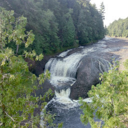
The Doughboys Nature Trail follows several other named trails, including the famous North Country National Scenic Trail. From the parking lot, follow the trail to the east. At the first fork, take the trail to the right -- this allows you to finish the hike with the best view of Copper Falls rather than finishing with a less scenic trek through the forest. After taking the fork, continue straight on this trail (further down the trail there is another intersection with a trail heading right, but go past this). Just before the trail starts curving to the southeast, you will arrive at an overlook viewing Brownstone Falls as pictured below. Here, the Tyler Forks River merges with the Bad River in spectacular fashion, pouring water into the rocky gorge.

The powerful Brownstone Falls raging through the gorge
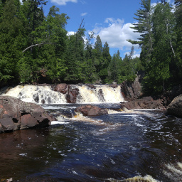
Once you cross a bridge, turn left. There will be another trail intersection, but continue straight, following the direction of the river. Right as the trail bends to the southwest, try to spot Brownstone Falls again. Eventually, there will be a final overlook for Copper Falls. Enjoy the views like pictured below, then keep going straight on the trail, through the next intersection, then cross a bridge over the river. Turn right after the bridge, and you will soon arrive back at the parking lot.

Viewing Copper Falls from the trail
Hiked on Thursday, August 11th, 2016 by Ricky Holzer
Important Information
You can bring your kids and your dog -- dogs are allowed on a maximum 8-foot leash only (leashes for kids don't have a maximum length here). You can hike the full loop only during Spring, Summer, and Fall; only the segment on the North Country National Scenic Trail is open for hiking during the winter. I went on a cloudy, misty weekday afternoon, and there weren't many other people hiking. However, this hike is on almost every top ten list about Wisconsin and nature, so although it is quite a drive from major cities, this place can still draw a crowd on weekends.
Directions
The Twin Cities is the closest major metropolitan area to this state park, and the drive is approximately 4 hours. Take Interstate 35 north, then exit onto Minnesota Highway 70 in Rock Creek. When you cross the border into Wisconsin, the highway number remains 70. Continue on Wisconsin Highway 70 until you reach Spooner, then head north on U.S. Highway 63. Once you reach Trego, turn right to stay on U.S. Highway 63. Continue on U.S. Highway 63 until you reach Hayward, then turn right onto Wisconsin Highway 77. In Clam Lake, turn left onto County Road M, then turn right onto County Road GG. Once you reach Mellen, turn left onto Main Street (Wisconsin Highway 13), then turn right onto Copper Falls Road (Wisconsin Highway 169). Look for signs for the park, and turn left onto Copper Falls Road.
Google Maps Directions
Parking, Fees, and Facilities
If you have Wisconsin license plates on your vehicle, parking is $8 for the day or $28 for an annual pass. If you are from out of state, parking is $11 for the day or $38 for an annual pass. See details here.
Nearby Hikes
Ottawa National Forest, Michigan
★★★★★(5/5)
Porcupine Mountains Wilderness State Park, Michigan
★★★★★(5/5)
Apostle Islands National Lakeshore, Wisconsin
★★★★★(5/5)
Porcupine Mountains Wilderness State Park, Michigan
★★★★☆(4/5)