| Rating | ★★★★★(5/5) |
| Overall Difficulty | Very hard |
| Navigation Difficulty | Easy |
| Distance | 8.4 miles roundtrip |
| Time | 6 hours |
| Terrain | Strenuous climbing, 2900 feet of elevation gain |
| Best Seasons | Spring, Fall, Winter |
| Family Friendly | No |
| Dog Friendly | No |
| Accessible | No |
Highlights
- Climb the tallest mountain in Texas
- Unbeatable panoramic views from the top
- Witness the scenic transition from desert to pine forest
Hike Summary
My 9th state highpoint and the highest 4-digit elevation state highpoint, Guadalupe Peak towers 3,000 feet above the Chihuahuan Desert at an elevation of 8,751 feet. As a uniquely Texan feature, this is probably one of the only mountainous state highpoints reachable on horseback. While the summit view is certainly the highlight of this hike, the entire trail is immensely scenic. In the strenuous 3,000 feet of elevation gain, you'll witness the gradual transition from the sparse scrubland of the desert floor to pine forest, and the views of the surrounding Guadalupe Mountains and endless desert continue to increase in beauty the higher you go. Even though it's only February, I'm already sensing this hike might make my 2019 end of the year top list.
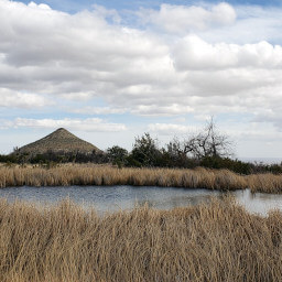
The trail starts in a valley between two prominent peaks of the Guadalupe Mountains: Guadalupe Peak to your left and and Hunter Peak to your right, pictured below. These mountains are so massive it's hard for the human eye to comprehend, though you'll soon understand after several hours of uphill climbing. Follow signs for the Guadalupe Peak Trail and turn left to take the hiking route -- there's also a more gradual route that allows horses but adds an extra mile.

The ridge topping out at Hunter Peak to the right of the trail

Wooden steps are common on the first part of the trail

Zigzagging switchbacks and the parking lot shrinking below you

Hunter Peak rising above the now forested scenery

Meadows and pine forests reminiscent of Colorado are found at higher elevations

The highest bridge in Texas

The summit monument built by American Airlines in commemoration of the 100th anniversary of the Butterfield Overland Mail stagecoach route

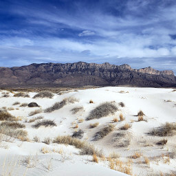
Views of the Salt Basin Dunes below and Franklin Mountains of El Paso in the far west

El Capitan and the Chihuahuan Desert extending into Mexico
Guadalupe Peak is a grand achievement. As the memories of the hard climbing fade, you'll be left with images of mountain scenery and long desert views. There is no doubt this hike is the highlight of Guadalupe Mountains National Park. Connect with me using the social media links below and share your adventures!
Important Information
As with most national parks, dogs are prohibited on all trails. This hike would be brutally difficult with children; more family friendly options are the Smith Springs Loop or the Pinery Trail. Spring and fall are the two best seasons. Although winter temperatures are generally pleasant and snow and ice aren't common even at higher elevations, winds are astoundingly high with gusts up to 80 mph common at the top -- not necessarily a deal breaker for the hike, but something to prepare for. In summer, temperatures are scorchingly hot on the lower part of the mountain and shade is rare. In addition, summer brings the threat of afternoon thunderstorms so a very early morning start is essential.
In all seasons, sun protection is crucial as is bringing ample water and snacks. Temperatures continue to decrease as you ascend to a height over 8,700, so bring extra layers. The rocky, steep trail makes good footwear a must! Despite its difficulty, the draw of climbing the highest peak in Texas makes this a popular trail, so choose another trail if you're looking for prolonged solitude.
Directions
From El Paso, take U.S. Highway 62/180 (Montana Avenue) east. After an hour and a half or so, turn left on Pine Canyon Drive for the Guadalupe Mountains National Park visitor center. Stop by the visitor center if you need to pay your fee with a card, otherwise continue to the Pine Springs trailhead parking area.
Google Maps Directions
Parking, Fees, and Facilities
Park entrance fees are $7 per person aged 16 and older and are valid for 7 days. Fees are payable either at the trailhead in cash only using provided envelopes or at the visitor center using card or cash. Annual passes for Guadalupe Mountains National Park are available for $30 and admit the pass holder plus 3 others. All interagency passes are also accepted and admit the pass holder plus 3 people. More information about fees and passes is available on the park's website. Park staff regularly patrol the lot, so don't forget to pay your fee!
This parking lot is deceptively large, but in reality much of the space is reserved for RVs. If you can't find a space here, you can park at the visitor center and hike in, adding about one mile roundtrip to your hike. The trailhead has flush toilets and water.
Nearby Hikes
Guadalupe Mountains National Park, Texas
★★★★☆(4/5)
Guadalupe Mountains National Park, Texas
★★★★☆(4/5)
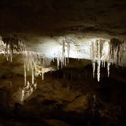
Carlsbad Caverns National Park, New Mexico
★★★★★(5/5)
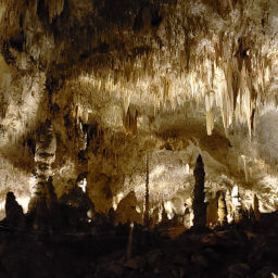
Carlsbad Caverns National Park, New Mexico
★★★★★(5/5)