| Rating | ★★★☆☆(3/5) |
| Overall Difficulty | Easy |
| Navigation Difficulty | Easy |
| Distance | 0.3 miles roundtrip |
| Time | 15 minutes |
| Terrain | Mostly flat |
| Best Seasons | Spring, Summer, Fall |
| Family Friendly | Yes |
| Dog Friendly | Yes |
| Accessible | Yes |
Highlights
- Cool Black Hills granite spires
- Less crowded spot for lunch near Mount Rushmore
Hike Summary
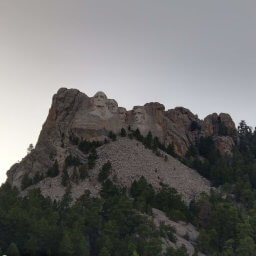
The Breezy Point Picnic Area isn't necessarily a secret, since it's well signed on the major highway to Mount Rushmore, but it's safe to say most Rushmore visitors don't stop here. I stopped here to make myself some lunch rather than paying for the high priced, low quality food at the Mount Rushmore food court. While the weather wasn't pleasant for me, this would be a beautiful place on a clear day. In the summer, the shady pines would provide nice relief from the hot sun.
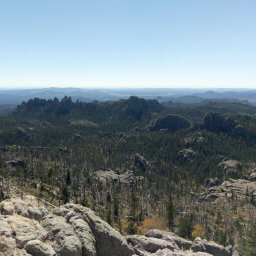
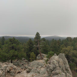
In addition to housing several picnic benches, this recreation area has a short, paved trail that could possibly be considered accessible (my own opinion) leading to two scenic overlooks of some amazing granite spires typical of the Black Hills. Follow the paved trail slightly uphill to find these overlooks. There is a fork in the trail, and you can go either direction; you will eventually return and go down the other path to see the other viewpoint. At the end of the trail, you'll enjoy a wonderful view of the rock formations in the distance, see the picture below. Despite the fog, I could still tell this is quite a beautiful sight.
Important Information
Dogs are allowed on leash. This is an excellent place for kids, giving them space to run around and exercise before or after visiting Mount Rushmore. The trail to the overlooks is entirely paved and gently sloped -- the official page does not designate it accessible, but my own untrained opinion is this is doable in a wheelchair. You can definitely visit in the three warm seasons, but access may or may not be possible during the winter -- the Black Hills National Forest closes some of its campgrounds and other recreation sites nearby during the winter, but I can't find whether this is one of them. Despite its nearly adjacent location to Mount Rushmore, I guarantee you won't find as many people here, making it a great spot to eat a lunch or a snack and relax in nature before or after dealing with the crowds.
Directions
From Rapid City, take U.S. Highway 16 west towards the Black Hills. Follow signs for Mount Rushmore, and take the exit for U.S. Highway 16A. Continue straight to stay on South Dakota Highway 244, drive past Mount Rushmore, and look for signs for the Breezy Point Picnic Area on the right.
Google Maps Directions
Parking, Fees, and Facilities
Parking is free! There is one accessible pit toilet and several picnic tables are scattered around.
Nearby Hikes

Mount Rushmore National Memorial, South Dakota
★★★★☆(4/5)

Black Hills National Forest, South Dakota
★★★★☆(4/5)

Custer State Park, South Dakota
★★★★★(5/5)

Custer State Park, South Dakota
★★★★☆(4/5)

