| Rating |
★★★★★(5/5) |
| Overall Difficulty |
Hard |
| Navigation Difficulty |
Easy |
| Distance |
8.25 miles roundtrip |
| Time |
4 hours |
| Terrain |
Strenuous climbing, 1400 feet of elevation gain |
| Best Seasons |
Spring, Fall |
| Family Friendly |
No |
| Dog Friendly |
No |
| Accessible |
No |
Highlights
- Panoramic views of Denver and the Front Range from the summit of Carpenter Peak
- Solitude and tranquility in the pine forest of the Powerline Trail
- Gorgeous grassy meadows and sandstone formations
Hike Summary
The crown jewel of Roxborough State Park -- my favorite park in the Denver metro -- is Carpenter Peak. While the climb is the hardest hike in the park, it's also the most scenic. And, instead of doing the Carpenter Peak Trail as an out-and-back hike, you can see even more natural beauty and fewer people if you take the slightly longer return trip via the Powerline Trail to the Elk Valley Trail. This 8-mile, half-day hike is an adventure, with enjoyable scenery throughout.
Starting from the visitor center, take the Willow Creek trail. Willow trees line the path and create a shady canopy above, as pictured below. Enjoy the shade while you can -- you won't find much more until after you summit the peak!

Tangled trees on the Willow Creek Trail
Stay right at the next two intersections, then cross the dirt road to begin your ascent on the Carpenter Peak Trail. On your left, you will have views of Roxborough State Park's famous sandstone formations, as pictured below. Later on in the hike, you'll see these from above.

Sandstone formations at the beginning of the hike
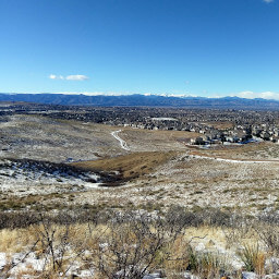
The beginning of the Carpenter peak trail is the steepest part, other than the last push towards the peak. Once you have passed the stair-like portions, the trail becomes more gradual. Again, there isn't much shade except for in a few spots with overgrown bushes or the occasional pine tree. Though the lack of shade can make for a sweaty hike, you benefit by having nearly constant views to your right. The views only get better as you ascend, as demonstrated by the two pictures below!

The jagged sandstone formations of Fountain Valley in the distance

The rocky ridges east of the park become visible as you ascend higher
After a series of switchbacks, you'll pass the intersection with the Elk Valley Trail. Soon after, the rocky summit of Carpenter Peak will come into view, as pictured below. Notice how the landscape changes as you ascend: you start in grassland, progress to the bushy slopes, and finish in the pines.

Denver views and the rocky crest of Carpenter Peak
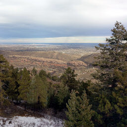
Eventually, you'll go over a hill to the other side of the mountain. The landscape changes abruptly to pine forest, then signs will point you to the final portion of trail to the summit. At the top, you'll enjoy expansive views of the Front Range and Denver area, as shown in the two pictures below. There are plenty of nice rocks to sit on and bask in the scenery. Note that the chipmunks who dwell on the summit are especially agressive and mostly unafraid of humans -- one almost climbed into my backpack in search of my snacks!

The pine forest and mountains west of Carpenter Peak's summit

Chatfield Lake and distant snow-capped peaks from the summit
Continue the loop hike by descending from the peak and turning right into the forest onto the Carpenter Spur Trail after about a tenth of a mile. From this point on, the trail is much less traveled, though signage is still very good. Take a sharp left once you reach the Powerline Trail, a rutted dirt road that goes along the edge of Pike National Forest. This route does involve traversing rolling terrain, so don't expect a downhill cakewalk! Most of the Powerline Trail is dense pine forest puncuated with meadows, as pictured below, allowing you to escape the sun and enjoy peaceful solitude.

Forest and meadow on the Powerline Trail
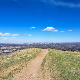
Once the Powerline Trail emerges from the forest, the scenery is spectacular -- my favorite part of the hike. As your surroundings start to resemble the image below, look for a sign on your left indicating the Elk Valley Trail. This trail winds around a hill and back to the Carpenter Peak Trail, providing nice southern views of the grassy valley and scrub-covered hills. When you reach the Carpenter Peak Trail, turn right and retrace your steps downhill and back to the visitor center.

Views from the Powerline Trail as you approach the Elk Valley Trail
Next time you're looking for a challenge but don't want to drive all the way into the mountains, try climbing Carpenter Peak! Connect with me using the social media links below and share your adventures!
Important Information
Dogs are not allowed anywhere in Roxborough State Park. This is a strenuous hike, so if you have kids, I recommend doing the Fountain Valley Loop. Spring and fall are the best seasons to hike Carpenter Peak; there is minimal shade on the way up, making summer less than ideal, and winter snow and ice may make the trail impassible. Roxborough is a popular state park, so expect to see people no matter when you visit. You will see significantly fewer people once on the Powerline Trail.
Directions
From Denver, take U.S. Highway 85 (Santa Fe Drive) south. Take the exit for Titan Parkway, then turn right. Continue straight through the roundabout and follow the curve as Titan Road turns into Rampart Range Road. Following the signs for Roxborough State Park, turn left on Roxborough Drive, then immediately turn right to stay onto Roxborough Drive. Pay the fee at the entrance station, then continue until the road ends at the visitor center parking lot.
Google Maps Directions
Parking, Fees, and Facilities
Entering the park requires purchasing either a $9 daily pass or $80 annual pass. Parking is extremely limited in the park, and cars often line up on the road to the entrance station to wait until another car leaves the park. Especially on weekends, arrive as early as possible to ensure a parking spot or a minimal wait.
The visitor center has flush toilets, water, exhibits, and a gift shop.
Nearby Hikes
External Links


