| Rating | ★★★★★(5/5) |
| Overall Difficulty | Moderate |
| Navigation Difficulty | Medium |
| Distance | 3 miles roundtrip |
| Time | 1.5 hours |
| Terrain | Hilly |
| Best Seasons | All |
| Dog Friendly | Yes |
| Accessible | No |
Highlights
- Navigate an absolutely silent forest
- Small waterfalls
- Ascend to the highest point in Michigan
Hike Summary
One of the joys of attempting to highpoint all 50 states is that it forces you to travel to impressive snow capped peaks as well as unremarkable yet sometimes surprising places. Mount Arvon is the 6th state highpoint I've achieved, and the tallest point in Michigan standing at 1979 feet above sea level. Viewed from afar, Mount Arvon is barely a blip on the horizon (very apparent in this Wikipedia photo), and the forest might as well be any other part of the Upper Peninsula. Yet this hike had something special, even though there are better views and better waterfalls from more accessible and better maintained trails near here. Even though this land is owned by a paper company and the entire length of the trail isn't far from a forest road (you can opt to drive to the top of Mount Arvon after all), I really felt a sense of the vast, undeveloped wilderness that exists in this country. This was also the quietest place I've been in a long time; while resting on a bench at the summit overlook, I didn't hear a single buzzing bug or chirping bird, just the soft sound of an occassional gentle breeze through the trees.
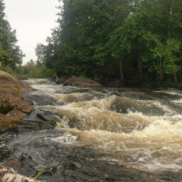
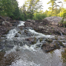
The trail is very lightly used, and for much of its distance there won't be a discernible path underfoot. Instead, you'll have to navigate by frequently placed blue rectangles painted on trees and rocks. If you've never hiked a trail that required navigation skills beyond following a graveled route beneath you, this is a great place to experience the pleasure and freedom of choosing your own path in the general direction of trail markers. The trail follows the creek pictured below almost the entire time, so as long as you see the creek alongside you, you won't lose your way. Even though you'll be traveling uphill almost the whole time, most of the trail is so gradual you won't notice.
Hiked on Saturday, August 11th, 2018 by Ricky Holzer
Important Information
There are no posted rules about bringing dogs, but it's important that you keep your pet under control and pick up after it. Mount Arvon is located on timberland owned by a paper company -- aka private property -- so access to this state highpoint could be revoked at any time if people do not respect the land. The hike isn't very difficult, but the rugged, unmaintained trail isn't suitable for children; instead you can drive kids to the summit and walk the short distance to the overlook. Access is possible in all four seasons, but the heavy Upper Peninsula snow means you'll either have to snowmobile or ski in 8 miles to reach the summit since these roads are not plowed. This highpoint is quite remote, and not many are willing to traverse the complicated network of forest roads to hike here. When I visited on a beautiful Saturday afternoon, there were other cars parked here, but I didn't see anyone while hiking to the peak (I even napped for a bit on the bench by the overlook it was so peaceful). I saw two others on the hike back to the car.
Directions
One of the most challenging parts about this hike is navigating to the trailhead through the labyrinth of dirt forest roads. Before smartphones, traveling here would have been quite confusing, but using Google Maps turn-by-turn directions while in the car has made this task much easier. You don't even have to worry about whether or not you have cell service if you download this area beforehand for offline use on your phone, just follow Google's instructions. I was able to search "Mount Arvon" on Google Maps and it was able to navigate me exactly where I wanted. You'll have it even easier though, since all you have to do is click the Google Maps link at the end of this section.
From L'Anse, head north on Main Street and it will change names to Skanee Road as you exit town. In about 10 miles, turn right on Arvon Road, an easily-missed dirt road labeled only by a tiny green street sign on a pole on the left side of the road. You'll be on dirt roads the rest of the time, and I had no problem driving them in a sedan, though muddy roads would have made it a challenge. From here on out, I'm not even going to attempt to describe where to turn next. If you want written directions, you can find them at the Summitpost page about Mount Arvon. Along the roads there are blue diamonds labeling most of the turns to Mount Arvon, see the picture below. Your best bet is to use Google Maps navigation while looking for those blue diamonds to assure you are heading the right direction.
Google Maps Directions
Parking, Fees, and Facilities
Parking is free! There are no facilities here or anywhere along the long drive on dirt roads you'll travel to get here; plan accordingly.
Nearby Hikes

Ottawa National Forest, Michigan
★★★★★(5/5)

Ottawa National Forest, Michigan
★★★★★(5/5)

Ottawa National Forest, Michigan
★☆☆☆☆(1/5)

Ottawa National Forest, Michigan
★★★★★(5/5)


